
Worn Out On Ireland’s Wild Atlantic Way
It took us a week from our ferry docking in Rosslare to actually reach the start of Ireland’s Wild Atlantic Way – we move slowly these days. It has taken only one day to have us questioning if we’re ‘doing it’ right. Lots of info here on the WAW route if you’re interested: www.thewildatlanticway.com.
After a great couple of nights in the aire at Cobh, it was time to do it, get onto Ireland’s Wild Atlantic Way. We serviced Zagan the motorhome, so he was brimming with water, with empty loo and waste water tank, then we drove to the petrol station just outside Cohb to fill up with diesel (€1.48/l) and do some laundry.
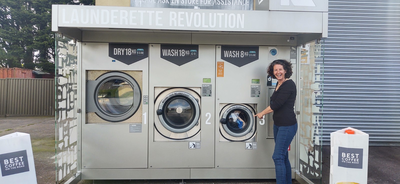
While the washing machine was doing its thing, we nipped across the road to the SuperValu supermarket (there is a Lidl and Aldi right next door to Supervalu, but we wanted to try something new) and refilled our cupboards.
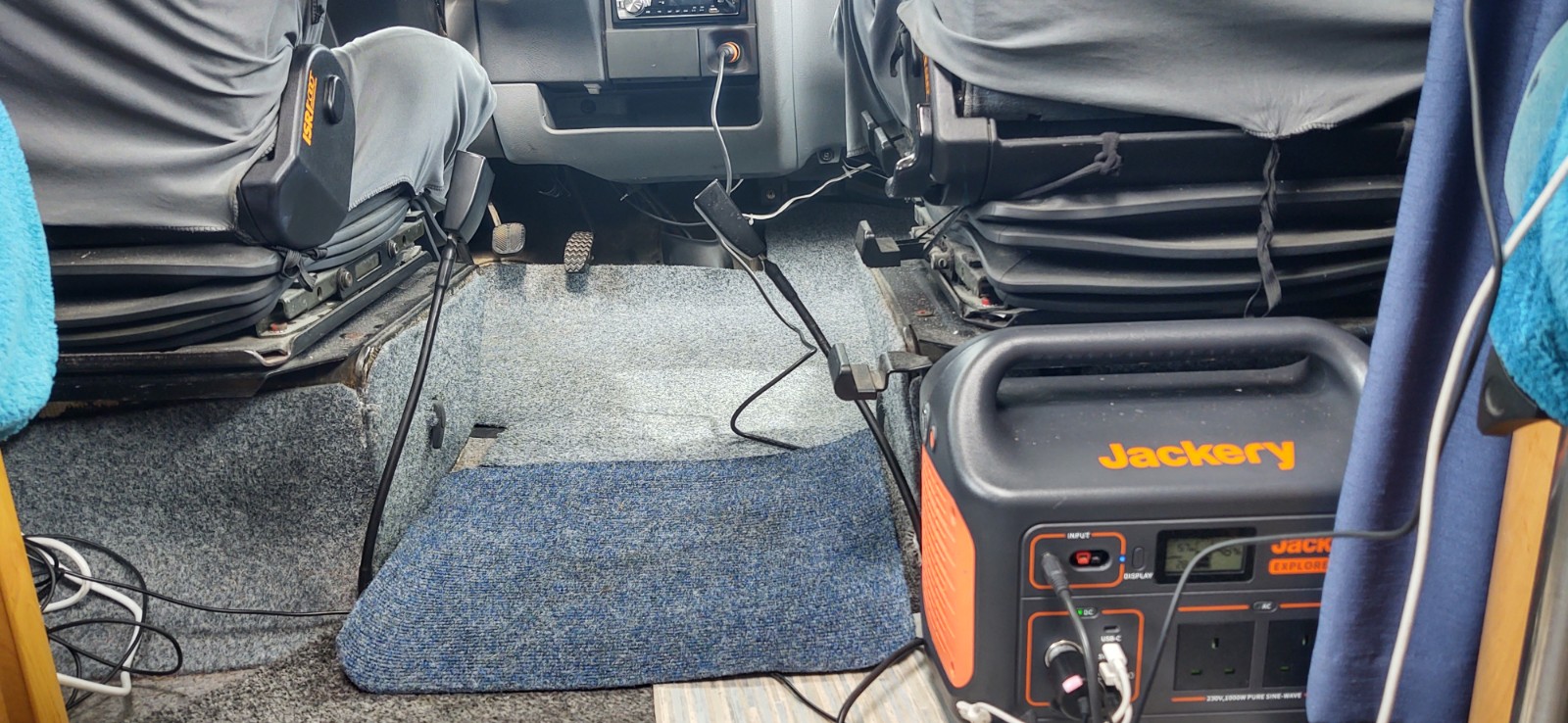
We knew it would be a decent day of driving with several stops along the way, so we set about recharging our Jackery powerpack, which we’d used in Cobh to put a decent charge into our ailing leisure batteries. We plugged the Jackery into the cigarette lighter so it would charge from the engine as we drove, then plugged our phones into the Jackery to charge and finally the satnav so we could navigate. There was a bit of a snake’s wedding going on behind my seat, but on our drive today we fully charged everything and put 12% back into the Jackery. The sun has also been shining, so our leisure batteries are nicely topped up – we might even get to watch some telly tonight.
Leaving Cobh we had two options to get around Cork’s huge harbour; the motorway or a ferry. We decided to have a go on the ferry – we used them loads in Norway and haven’t been on one since.
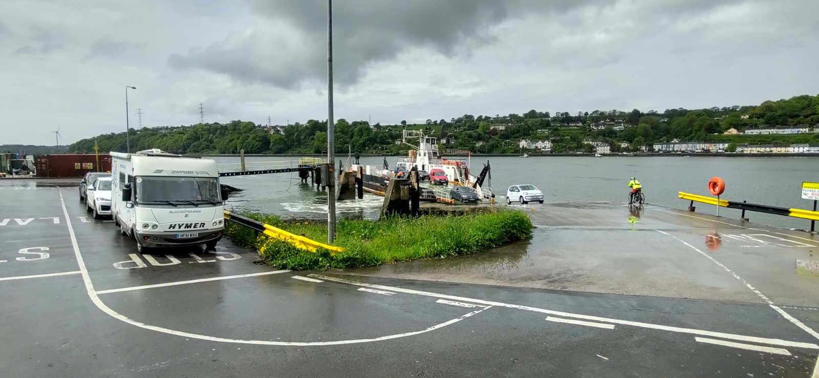
The ferry docked and Jay carefully drove Zagan on board as the chap taking the fares warned us some vans ground out their rears while boarding. Luckily Zagan hasn’t got much of an overhang, so he got on easily and we were only charged the car price of €8 (which seems to be the norm for motorhomes). It probably would have been cheaper to drive around on the motorway, but this was way more fun.
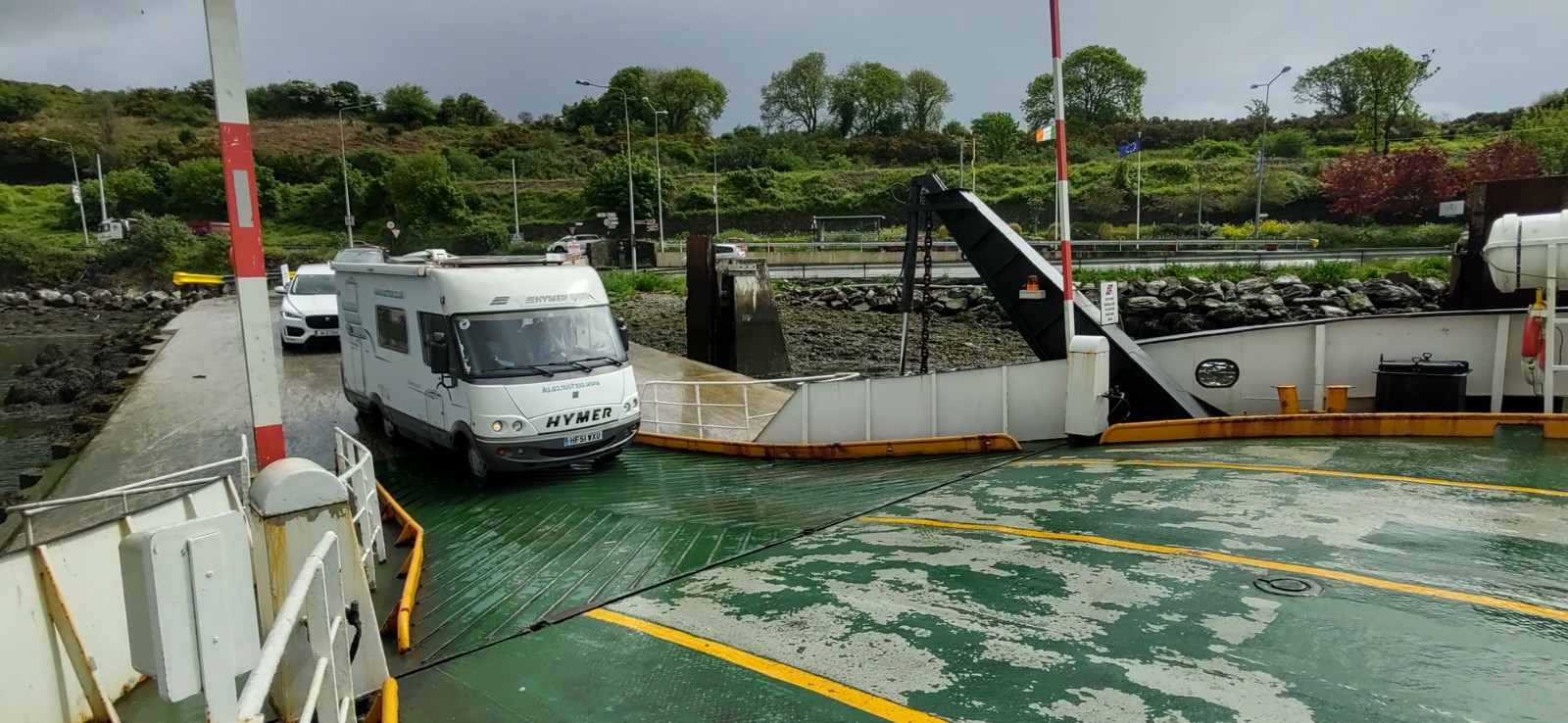
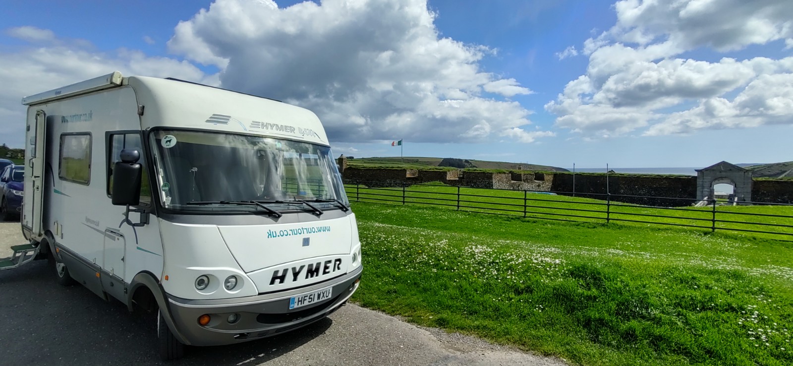
Five minutes later we were off the ferry and on our way to Kinsale, and the start of the Wild Atlantic Way. Instead of trying to park in the town itself, we opted to park at Charles Fort, one of Europe’s best preserved star-shaped artillery forts. Having seen several star-shaped forts on our travels, we didn’t go in, but used the ‘Scilly walk’, a 3km path along the coast, to get to the town.
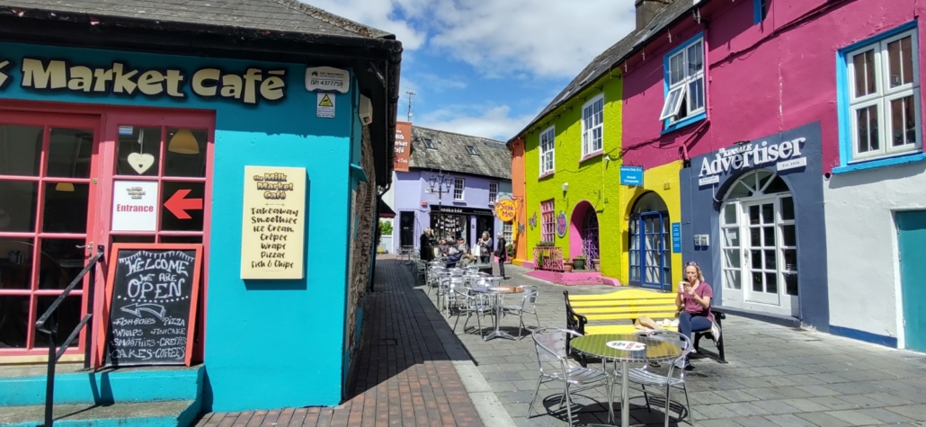
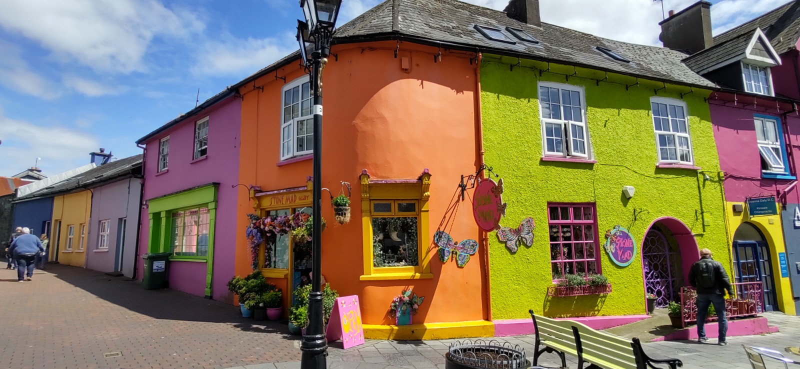
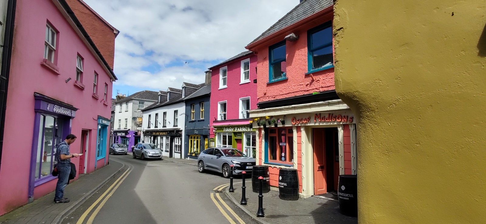
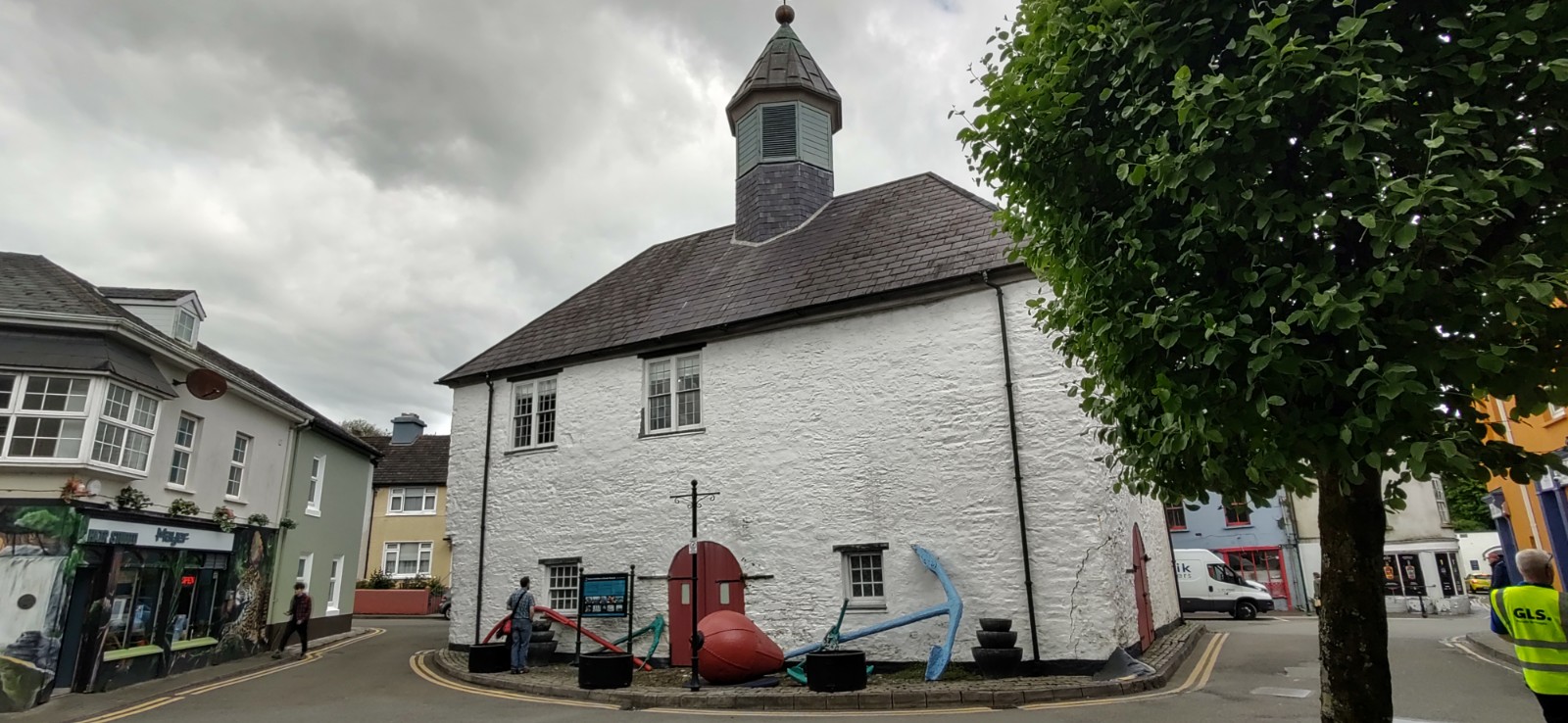
Once in the town we nipped into the tourist information office to grab a few leaflets. Then, as the sun was out, we headed straight for the brightly colored buildings that Kinsale is famous for. There are only a few, located in just a couple of streets, but they are very photogenic.

I spotted a book store and popped in to treat myself to a decent road map of Ireland. Our current AA map includes the island of Ireland, but has the whole of it across two pages so only shows the main roads. We’ve seen photos of a motorhome being towed backwards up a narrow Irish lane because it couldn’t go any further or turn around. To avoid us ending up down a farm track, I decided it would be worth buying the AA Ireland Roadmap. It cost quite a bit more than it would have done from Amazon, so if you’re thinking of coming over here, it might be worth picking one up before you set off.
The map from the tourist office listed the ‘old famine graveyard’ as a sight to see in the town, so we walked a mile or so out of the town to it. It was at this point that we realised Kinsale is somewhat lacking in pavements. Don’t get me wrong, the drivers are all great, slowing right down and giving loads of room, but on a narrow, bendy bit of road it is quite unnerving.

Arriving at the graveyard we were somewhat shocked. I’ll be honest, I wasn’t sure what I expected, but in reality it’s just a patch of land with an entrance gate, information board, memorial cross and some trees dedicated to individuals. Reading the information board it became clear why there were no marked graves. It’s the resting place of an unknown number of individuals who were victims of the great famine of the 1840’s. Some died in the huts of the nearby workhouse huts, some in their homes and others in desperation died along the roads to the workhouse.
The workhouse complex had been built to house 500 people but there was twice that number in there in 1846/7. This caused diseases such as yellow fever to spread rapidly. By 1849 there were over 2,200 in the workhouse huts and 120 buried in a single day in unmarked graves. Sadly there was no time, or money, for gravestones or any way to mark those who had passed, something unthinkable today.
Back down in the town we spotted nautical looking stuff (my technical term) outside the back of a museum. Among the anchors was a davit, used to launch lifeboats, from the Lisitania. There was also a navigation buoy that broke away from its mooring in Boston harbour in the USA in the nineteenth century, and drifted on the gulf stream to Kinsale harbour. I always make a point of touching things like this, they are after all a piece of history. The information board solemnly told us that the buoy would have floated past the emigrant ships that took the starving Irish away from the great famine to cities like Boston, New York and Philadelphia.
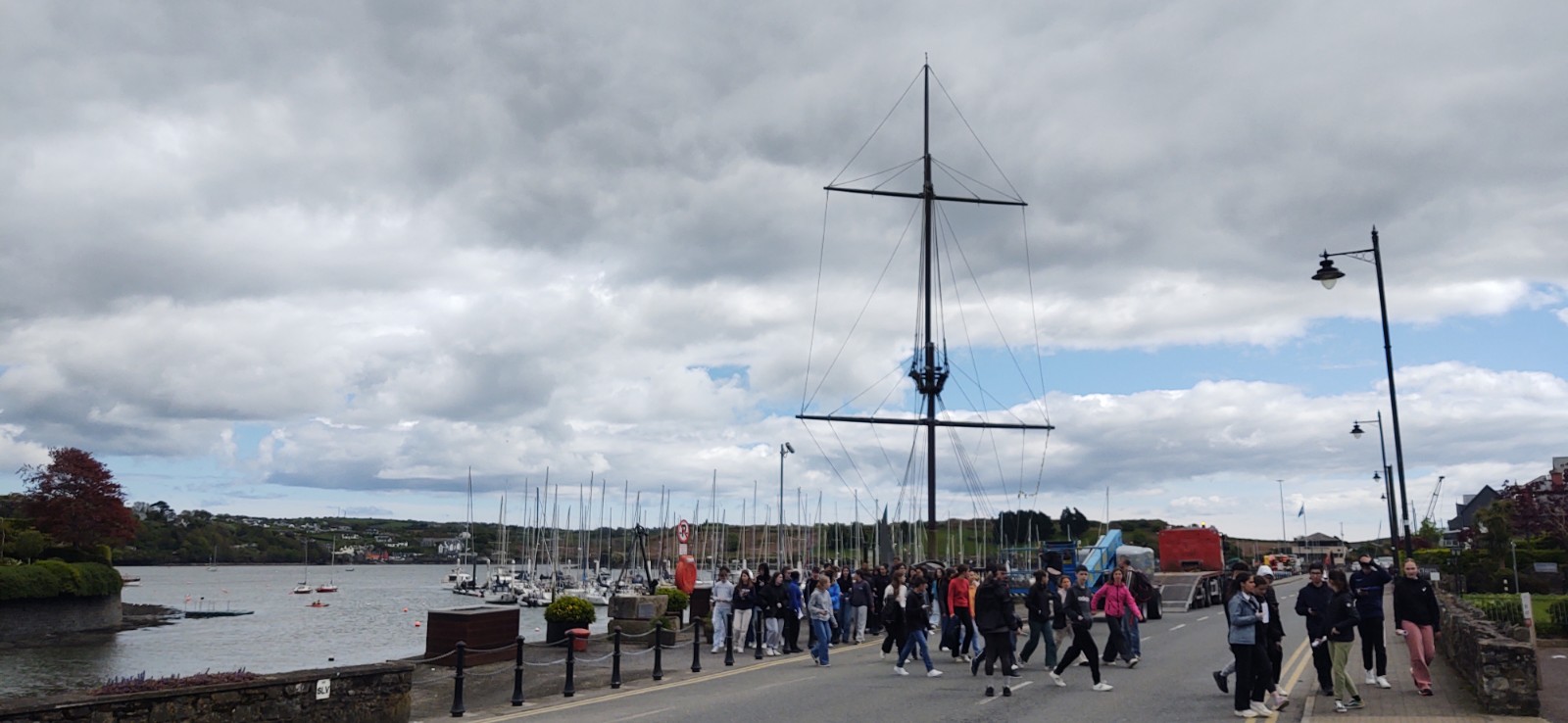
Knowing we had the walk back to the fort to do, we made our way to the seafront to see a mast from a Spanish Galleon ship, but it turned out to be a replica built to commemorate the 400th anniversary of the Battle of Kinsale. The Spanish fleet which had anchored at Kinsale to help the Irish fight the English, was beseiged by the English in September 1601. Irish forces marched to Kinsale to liberate the ships, but were defeated on Christmas Eve that same year. As a result, the Catholic Irish were banned from Kinsale. This moment is now seen as the beginning of the end of Gaelic Ireland. The mast was proving very popular today with a school party of French children learning about its history.
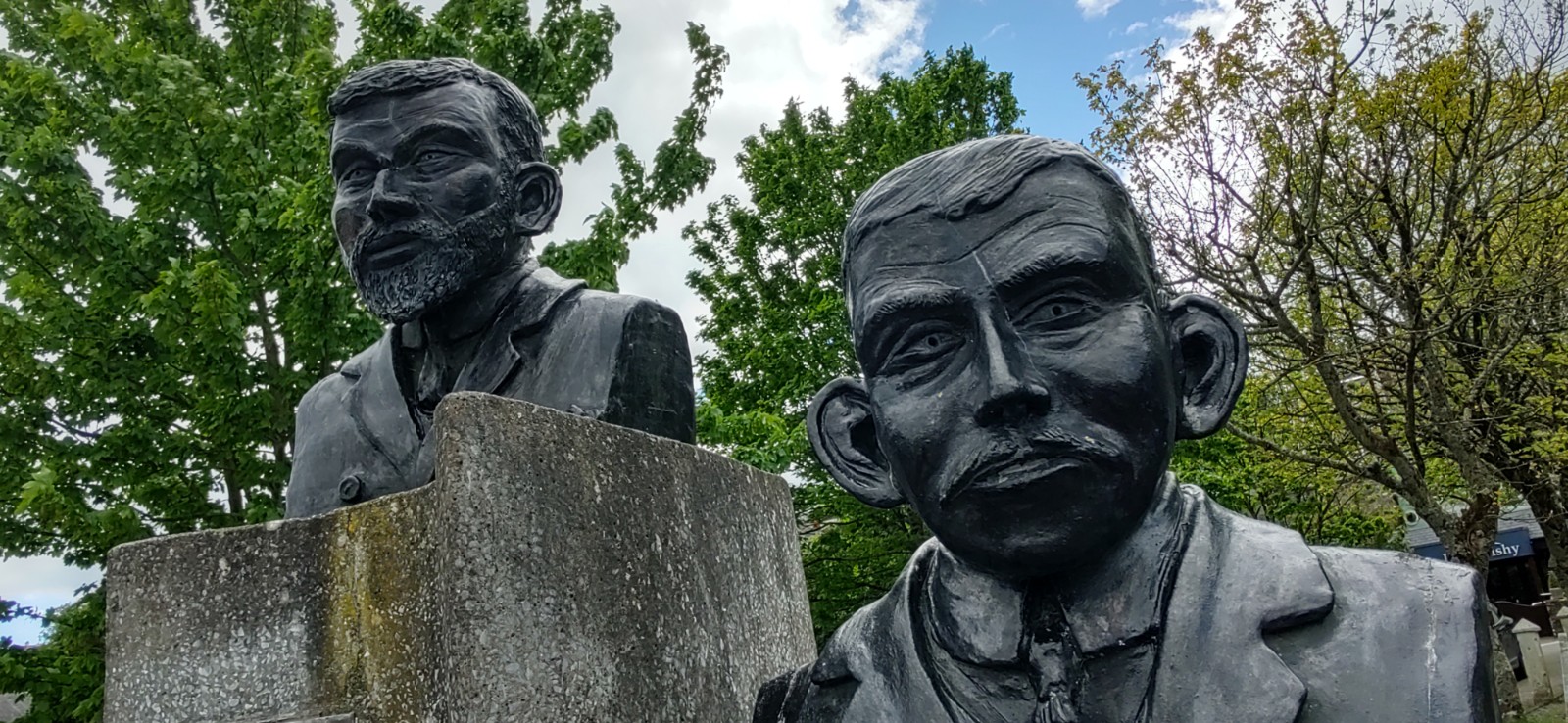
Our last stop was a memorial to Mortimer and Timothy McCarthy. The brothers were born in Kinsale and both became explorers. Timothy was a member of Shackleton’s Imperial Trans Antarctic expedition on Endurance which got stuck in the ice, he was part of the six men team who went to get help to rescue his crew mates, while Mortimer was the helmsman on the Terra Nova on Scott’s ill-fated expedition to the South Pole. They clearly breed tough men around here.
Two and a half hours later, we got back to Zagan and set off for our next stop. Now on the Wild Atlantic Way, wiggly blue and white road signs marked our route, however with satnav set to Lorry and Easy mode, she directed us onto the bigger roads where possible, so it was a good job I’d bought that map.
A twisty drive later, which got Jay’s back aching, we arrived at Old Head Signal Tower. One of the Wild Atlantic Way’s Signature Discovery Points – their version of a ‘must see’. It’s the most Southerly point on the route and seen as a good starting (or finishing) point of the tour. The is one of 81 built within sight of each other over 200 years ago and looking at the photos of what it used to look like, has been significantly restored (Trigger’s Broom anyone?).
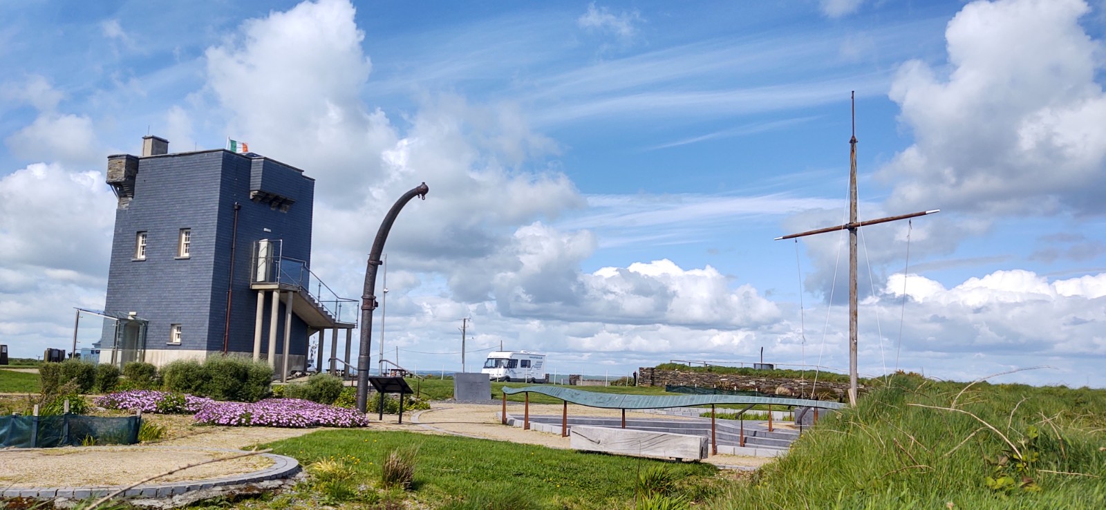
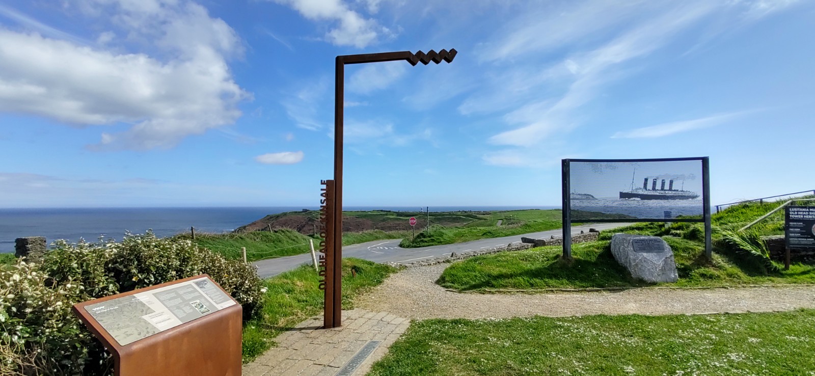
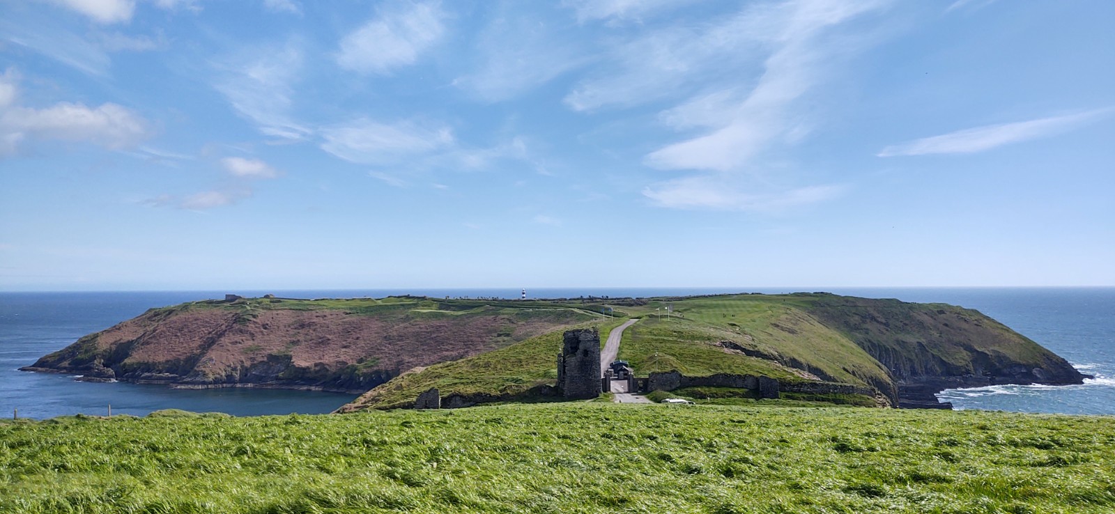
Already feeling weary, we decided against going into the tower which houses a museum dedicated to RMS Lusitania – after all we had learned a lot about the disaster at the Heritage museum in Cobh. We stayed for a quick brew and a walk over to look at the headland of Old Head itself. It is off here that the Luistania was actually sunk, but it is now a private golf course, so you can’t get close.
Setting off for our final drive of the day the beautiful coastline filled our windscreen. However the narrow, twisting roads were taking their toll. You would not believe how pleased we were when we found ourselves behind a slow moving lorry.
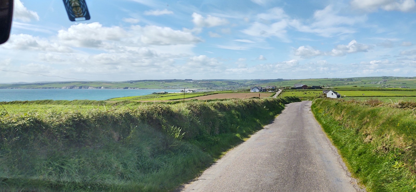
When satnav once again diverted us off the Wild Atlantic Way route and onto a major road, I kept quiet. There will be plenty more beautiful bits of coastline coming in the next few weeks, our goal today was to get to our park up for the night in one piece. We’d already changed our over night spot to one closer, and we were extremely happy to arrive and park up for the night at beautiful Red Strand beach (N51.54829, W8.9255)
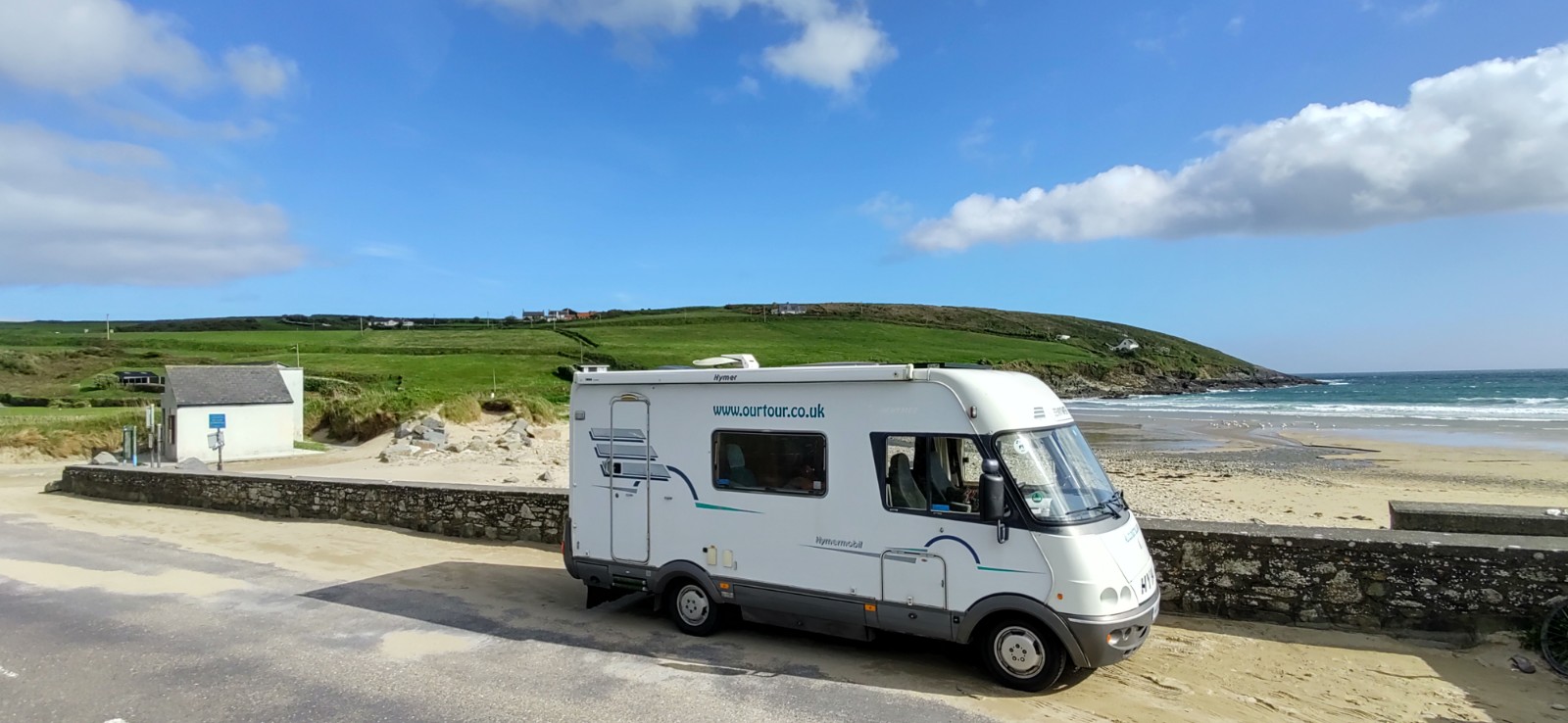
We realise that on trips like this, it’s the journey and what you see on the way rather than the overnight place you stay that are important. Let’s face it, while it’s a beautiful overnight stop there’s nothing here other than the beach. However, we love to drive and park up somewhere knowing that we don’t have to move the motorhome again.
At the moment we’re trying to squeeze in everything between Kinsale and Bere Island so we can do the Parkrun on Bere Island on Saturday. This will mean some long driving days, and lots of twisty roads if we’re going to stick to the official route. The maps will be out again tonight and we’ll have a think about how we’re going tackle this trip so we get to fully enjoy what Ireland has to offer.
Ju x

")
")


Hi there
We are doing all the WWW and are in Mayo now. We had exactly the same experience as you on the first couple of days going from Kinsale, the roads were terrible and we had to reassess where we were actually going to visit. To see the major sites you have to use some very small poor roads, but some roads are fine, you just have to grin and bear it. Not sure how far you’re going but we feel the roads do improve north of Dingle. Have fun. Martin & Kay
Cheers guys, we’ve taken it steadier today, used more of the national roads and it’s been a lot more fun. Hope you have a great tour of Ireland, Jay
great place to visit, thank you for creating this article