
The Gelmerbahn, Gelmersee and Furka Pass
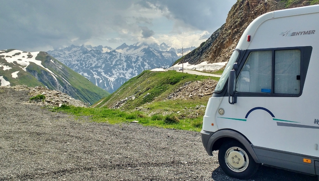
Zagan the motorhome is back on the top of the world, sitting at 2436 metres above sea level on the Furka Pass (N46.57225, E8.41444) in Switzerland, after a fantastic day taking in the Gelmerbahn and Gelmersee – more on those two later.
On Monday, it was time to leave our private mountain road car park, under the Stein Glacier. As had been forecast, the weather had turned and the heatwave had finally broken. In all honesty I didn’t really appreciate the coolness as I was pummelled with hail while packing away our chocks. The road around us now more like a river as we inched our way slowly off down the Steinalp Road and back onto the Susten Pass.
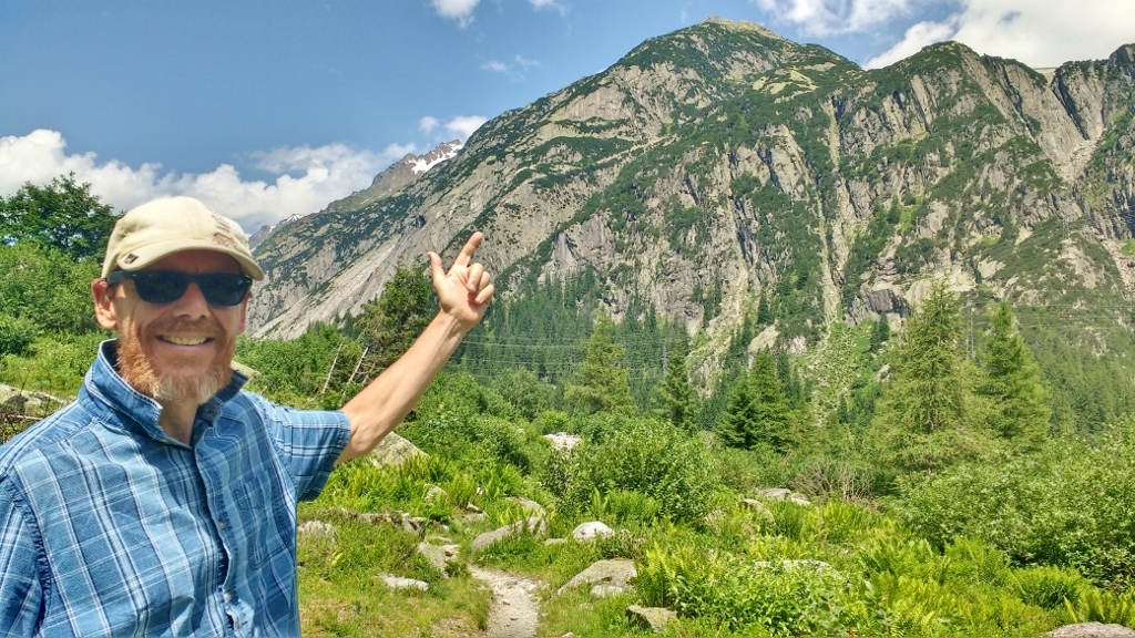
This is how happy I feel when I get the motorhome insurance sorted!
Almost back to the valley floor we passed a convoy of sports cars on their way up the Susten Pass, they all had their soft tops down and were adjusting GoPros to film the epic drive. With the hail we had just left, we suspect their footage may be quite entertaining. We arrived at Camping Aareschlucht (N46.70974, E8.21516) which is in Innertkirchen where the Susten and Grimsel passes meet. The site is in our ACSI discount campsite book and offers a reduced rate until 7th July, we would have stayed longer but it soon became apparent that the weather forecast had got it wrong.
We were given leaflets of what there was to see and do in the local area, which we looked through in the shade of Zagan’s awning as the temperature began to creep up. As it peaked at just over 39°C we decided not to do anything, but try and stay cool, and formulated a plan to get back to high altitude as soon as possible – clearly the heatwave was still in full effect. By 7pm the air started to cool down to the low 30’s and we scraped our melted selves off the camping chairs and went for a short walk. It turned out the big attraction in the area, the Aare Gorge (Aareschlucht in Swiss) was right by the campsite (no wonder they share the same name!). We know this because we spotted the walkways clinging to the side of the gorge as we cooled down on a bridge over the icy Aare river – the same river we saw folks swimming in when we were in Bern, brrrr!
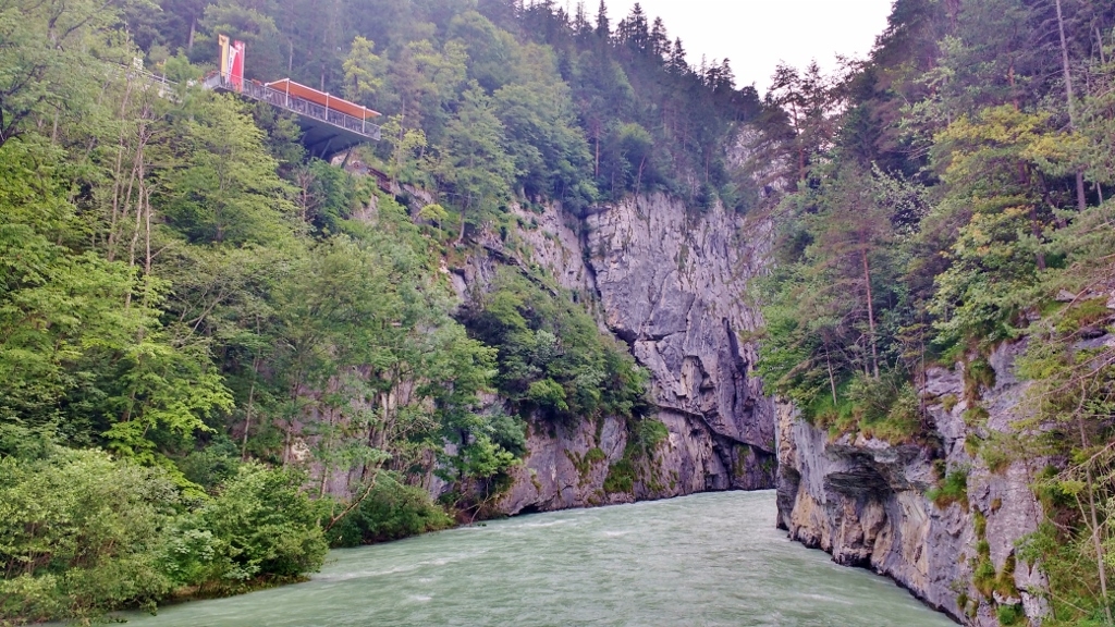
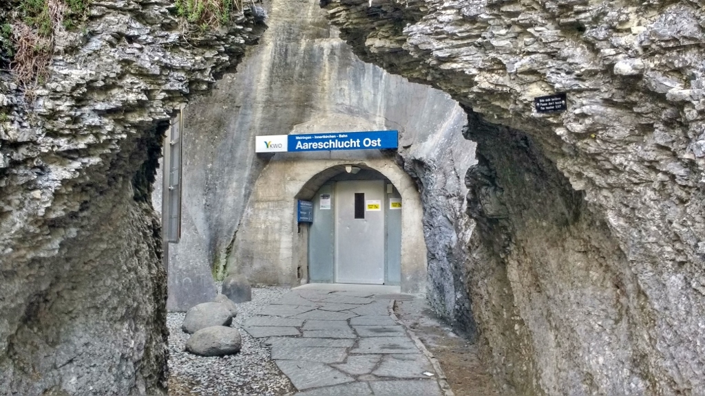
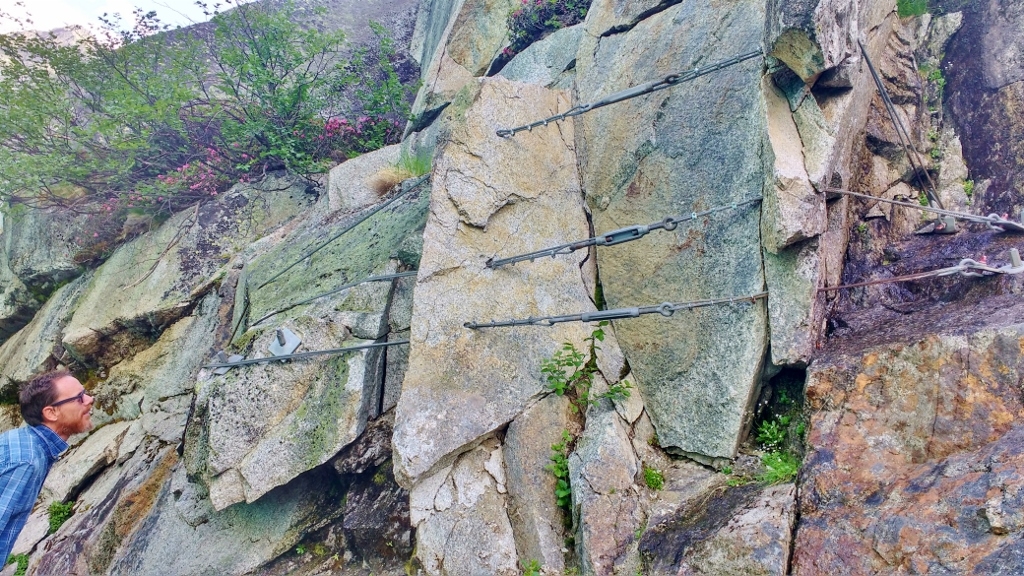
We’ve driven many, and walked several gorges during our travels. Looking at this one from the bridge it reminded us of a cross between El Caminito del Rey in Spain and the Vintgar Gorge in Solvenia. The gorge walk would have been much cooler than sitting in the shade of Zagan, however we would need to get back, which would involve either a hike through a forest or catching the train. Yes, those ingenious Swiss folks amazed us once again with a train line running through the rock next to the gorge – there is a station at each end. We found the East station by accident, wondering why there was a bridge over the river when all there was on the other side was a wall of rock.
Back at Zagan the evening finally started to cool down with big fat drops of rain. As it grew dark rumbles of thunder could be heard in the distance, then flashes of lightning. By 11pm we were in the thick of a full-on thunderstorm, our eyes struggling to adjust to the bright flashes as the thunder made the earth rumble beneath us. Once it had passed, we were able to open the windows once more and let in the cool damp air which helped us sleep.
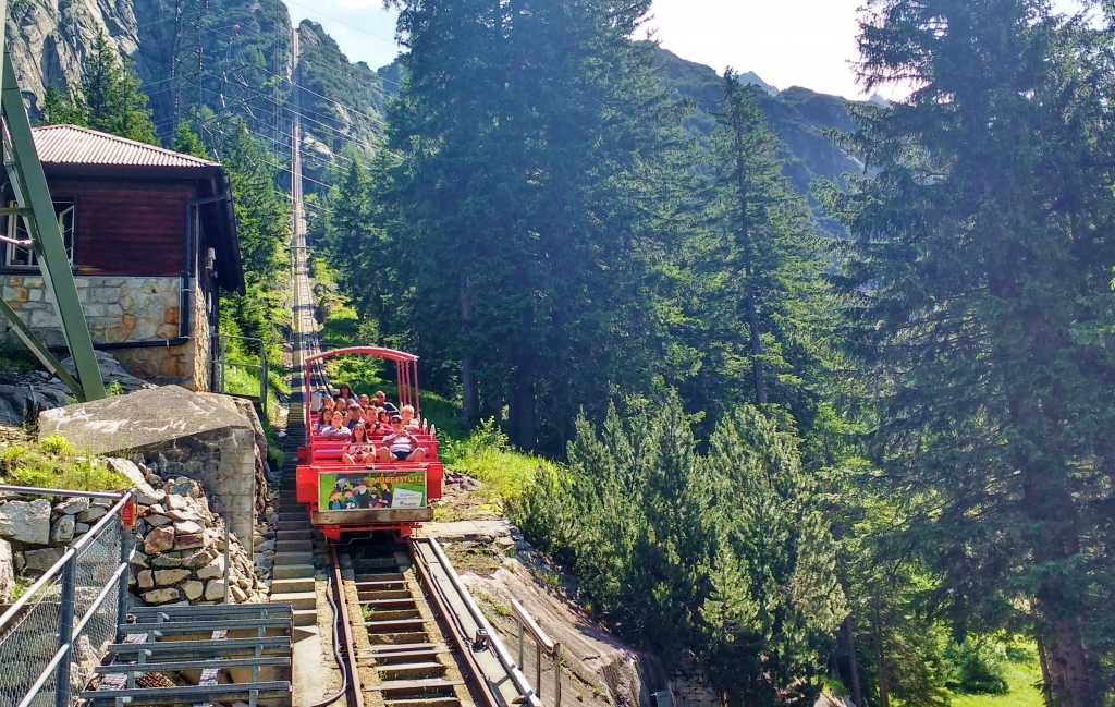
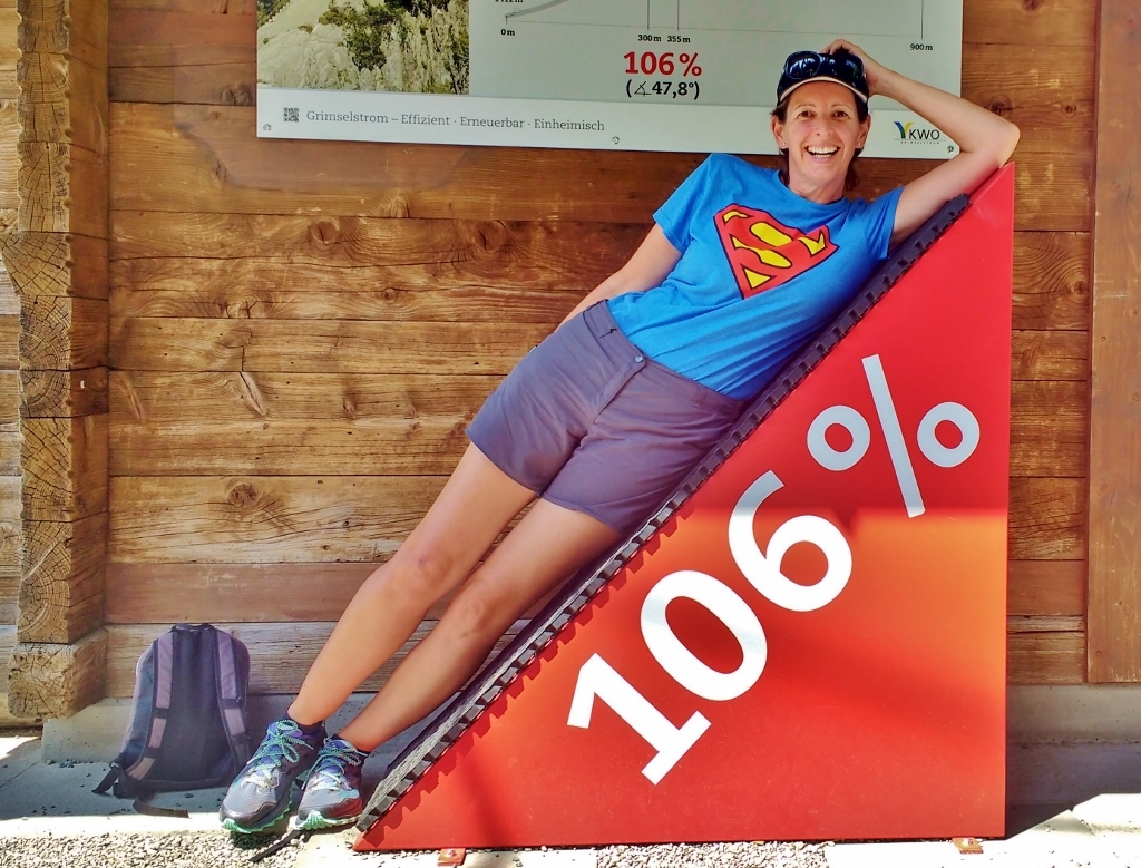
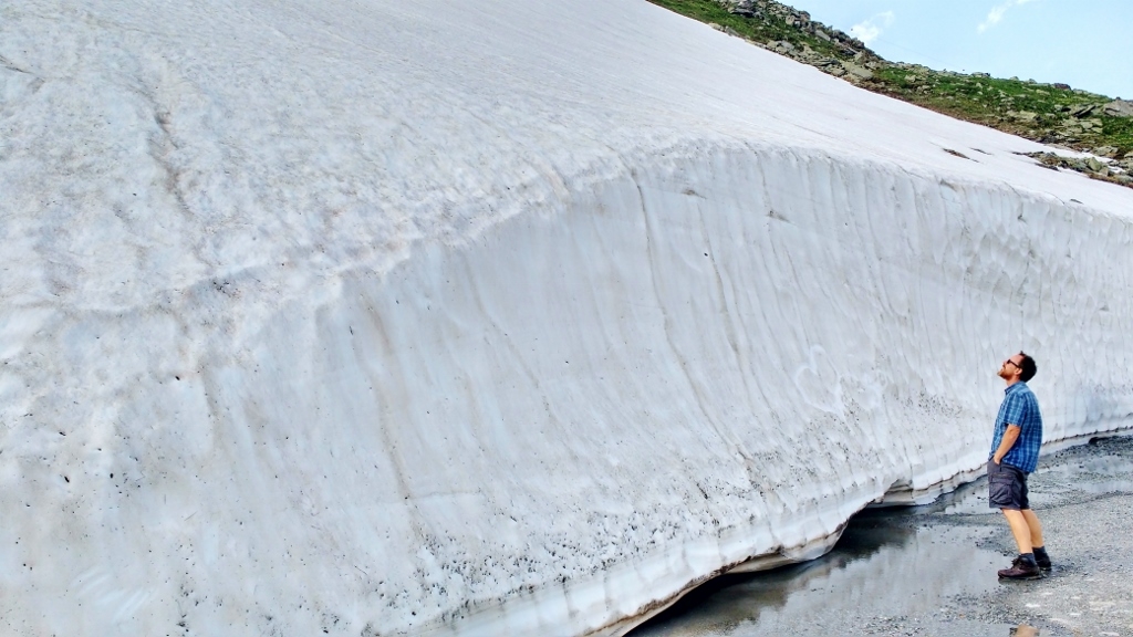
This morning after a quick sightseeing jog around Innertkirchen (it was so nice to run on flat ground for a change), we geared up and headed for the hills. This time we took the Grimselpass out of the valley and headed for the Gelmerbahn – a funicular railway. As you might guess, we’ve also been on quite a few funicular railways during our travels – from the sedate electric cars between the aire and beach at Le Treport in France, to the stunning Flamsbana in Norway. However the Gelmerbahn has been on our bucket list since we last passed by in October 2012 just a few days after it had shut for the winter. Why? Well it was the steepest one in Europe back in 2012, with one section at a mind-boggling 106% (the Stoosbahn, also in Switzerland, which opened in 2017 has a 110% gradient). Unsure how steep 106% is? I’ll show you!
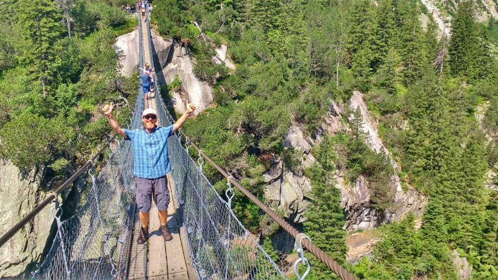
This time instead of being empty the car park was almost full. The place was in full-on summer mode, with many languages being spoken at the ticket kiosk. We had time for a wander over the Handeckfallbruke – the 70m high suspension bridge next to the train line, last time we had it to ourselves.
Being here in season, when the funicular is running, does have its advantages. We tried, unsuccessfully, to walk up the steps next to it in 2012 – we were a little more out of shape then, but I bet we wouldn’t get very far these days either. We were in luck as there were two seats left on the next trip going up (it’s 32CHF return or 16CHF one way – half price for children and if your dog is over 30cm tall to its shoulder, it will need a child’s ticket!). With a packed lunch in a rucksack we bought a one-way ticket so we could enjoy the hike back down.
We managed to bag two front carriage seats and with a safety bar over our laps like on a roller-coaster, and our feet at odd angles on a board that would soon be the floor, we set off.
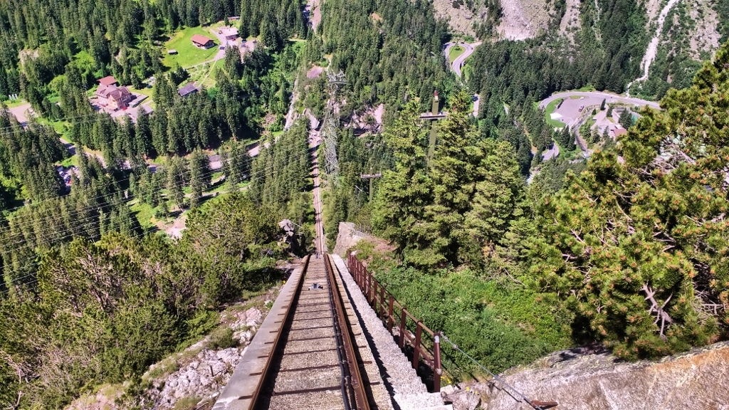
Soon the ticket office was a dot below us. Don’t get me wrong it doesn’t go fast – around 2 metres a second, but because it rises by 448m in just over a kilometre of track, you’re quickly looking at snow-capped mountains instead of the green gorge below. It wasn’t really an adrenaline ride, but it was still good fun and had us chuckling as it kept going steeper just when we thought it had maxed out.
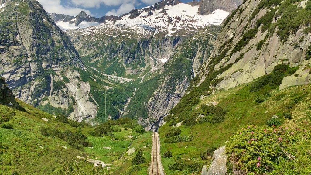
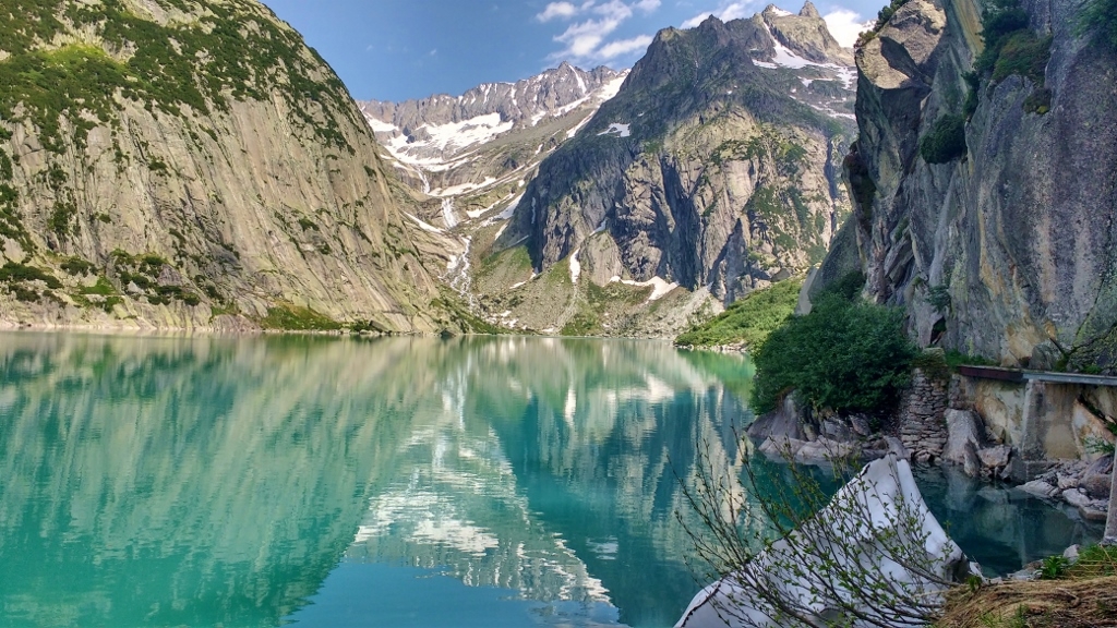
At the top we climbed out and walked down a short path, ahead of us the shimmering blue of Gelmersee. This is why the funicular was built. The reservoir was created by the building of a dam in 1926, and the workers needed to get materials up the mountain to build the dam, so the railway was constructed. I’ll never cease to be amazed at what the Swiss have done in order to tame mother nature.
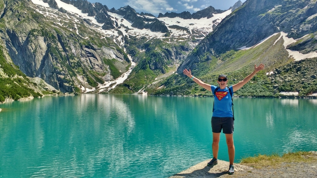
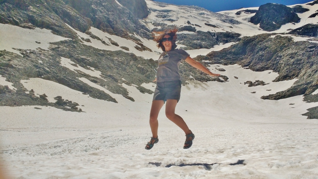
We spent about half an hour wandering around the edge of the lake, taking more photos than we would have had on a roll of film (if you don’t know what I mean, ask your parents). There’s a route all the way around Gelmersee, but there is still an unseasonable amount of snow on the paths, so we were advised to avoid some areas. Yes folks, it’s July, the middle of a heatwave and it’s still snowy up here.
After a spot of lunch we set off on the trail back down to the car park. Over two hours and eight kilometres later, we arrived back at Zagan. The path back down was amazing and I am so glad we opted not to take the train. We ended up using stepping stones to cross torrents of melted glacier (some more successfully than others – let’s say!), clambering down some heebeegeebee stone stairs with a huge drop off on one side and geeing on a group of school children who were climbing up (albeit somewhat reluctantly – I’m pretty sure health and safety wouldn’t allow that in the UK), all surrounded by stunning scenery.
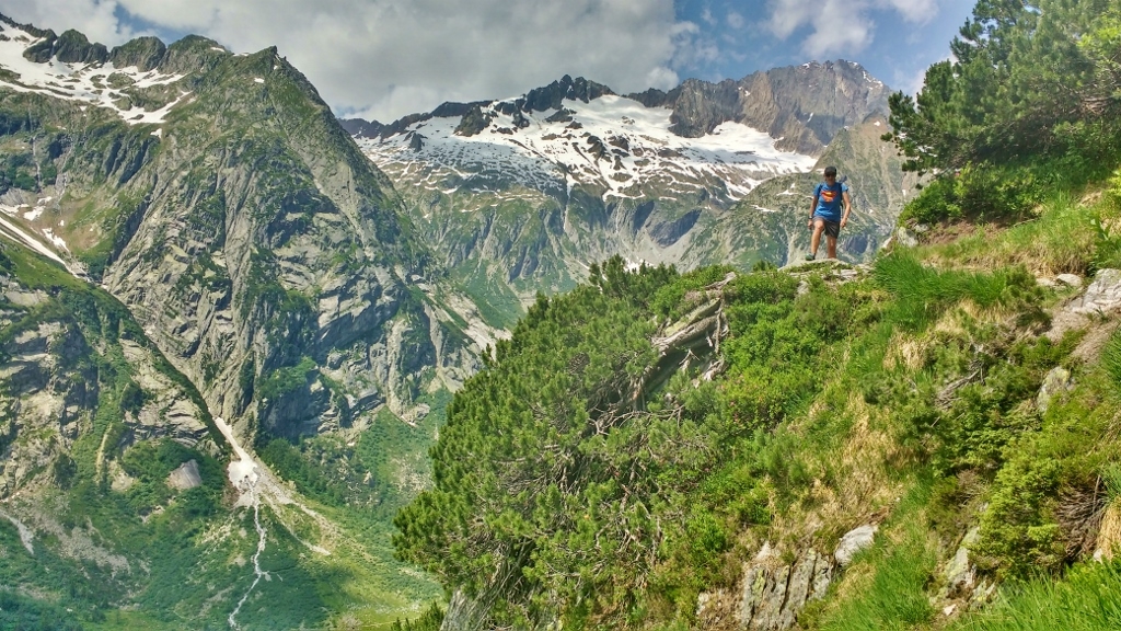
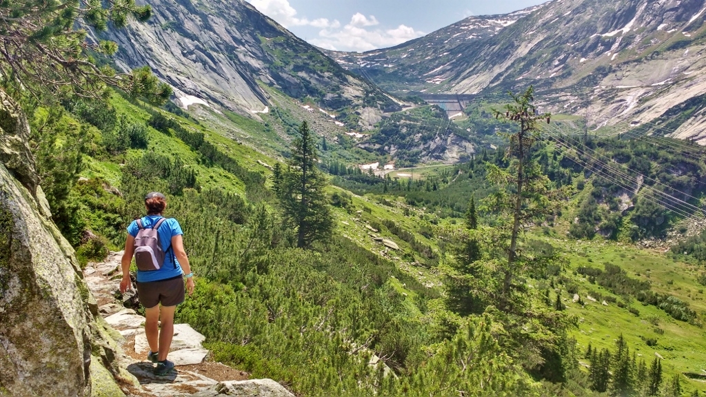
The route back down took us along the slopes on the other side of the valley from the funicular. It took us a while, but eventually we spotted it on it’s way back up the track.
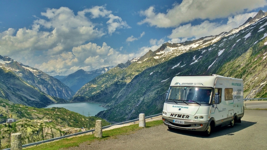
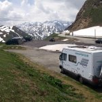
Back at Zagan it was time to make tracks to somewhere high up to stay for the night. We carried on up the Grimsel pass, winding our way around hairpin bends along with motorbikes, sports cars, fellow motorhomes and the Postbus which plays a great tune on its horn as it approaches a bling bend. We paused in one of the many lay-bys to take a quick photo of Zagan with the view back down towards Innerkirchen, as he does like having his pic taken in beautiful locations – before topping out.
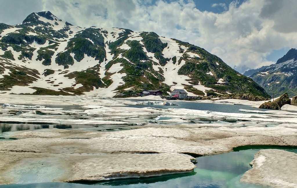
Having slept on the top of the pass before (and nearly getting snowed in on it), we opted to push on to the Furka pass. Reaching the top we could see we had made the right decision, it was a bit of a circus up there. The car parks were filled with coaches and cars with everyone looking out across the lake. I turned and discovered why – it was still frozen, just. An ice blue lake with a sea of ice bergs slowly melting into it. In the sunshine it was stunning, but sadly the photo doesn’t do it justice.
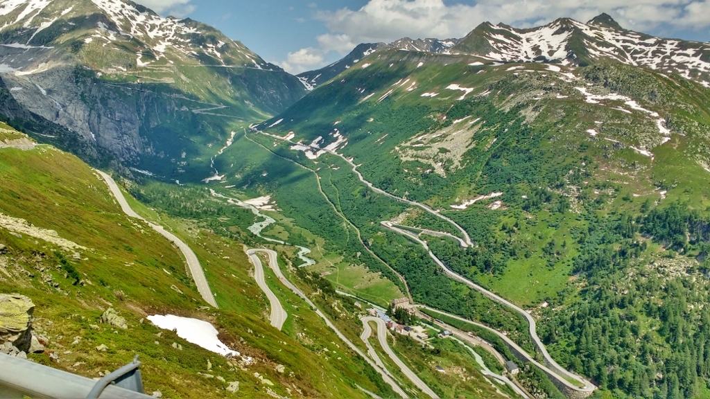
Having topped out on Grimsel Pass there was only one way to go, back down many, many hairpin bends until we reached the valley floor and began to climb back up again on the other side – the Furka Pass. The screen on satnav now resembling intestines.
Three kilometres from the top of the Furka Pass we passed the entrance to an ice grotto, housed in a glacier which is apparently the source of the Rhone River – I must check how cold it is next time we’re parked alongside it. As we approached the pass the walls of snow at the roadside got taller, and we were relieved to find the parking area is on the other side of the road.
So that’s us tucked in for the night. There are a couple of other vans up here, which is always reassuring, especially when the weather forecast says more storms tonight, and the temperature is chilly enough for us to be under blankets – the same blankets we couldn’t even bare to think about touching in the super-heated valley a few hours ago. We might stay here for a couple of nights as the pass is at the same height above sea-level as the finish line for my run on Saturday (Jay’s is about another 500m higher), so it will be good to get used to being at this altitude as I was feeling dizzy when we were on the glacier road, so my body still needs some acclimatisation.
As for the Zermatt Ultra and Half Marathons, the forecast for Saturday looks like it’s going to be hot (for Zermatt) at around 21°C when I start, but obviously getting cooler the higher up we go. There are storms predicted for the afternoon, so we’ll have to get up there as fast as we can! We also want to say a massive THANK YOU to all of you who have supported us with a donation for the British Lung Foundation on our just giving page. Over the weekend we reached our target of £1000, and we are humbled by your generosity. But with a few days still to go until the run, we’re hoping you might be able to help us smash it! If you would like to support us, you can do so HERE.
Ju x

Leave a Reply
Want to join the discussion?Feel free to contribute!