
On The Edge of The North Coast 500 – Carrbridge, Scotland
Zagan the motorhome arrived at his current stop in the dark. He, and we, forgot how much we don’t like driving in the dark, so today served as a sharp reminder. However, our blast north in the fading daylight has brought us to Carrbridge (N57.28254, W3.81304) just a few miles from Inverness and the start of the NC500.

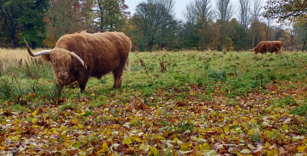
After my morning run to say farewell to Ed and Dave (the highland cows at the campsite in Edinburgh), we packed up and headed to the Queensferry Crossing bridge (which was still being built last time we were up this way in 2015). By now the skies were deep grey and, as we drove over the Firth of Forth, the light sideways stingy rain turned into thick heavy rain – even the motorway signs flashed up warnings to tell us how bad it was going to get. We found a free parking space by the sea to sit out the bad weather and to wait for a meeting we had set up to do some filming, which was the catalyst for this trip up to Scotland.
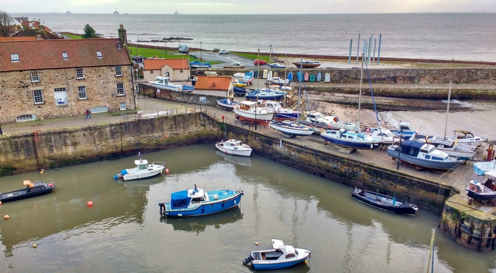
We holed up in a car park between the small harbour and a row of 18th Century seafarers’ houses at Pan Ha’ in Dysart (N56.12328, W3.12244). Despite the rain thrumming on Zagan’s roof and gusts of wind rocking him from side to side, Jay ventured out for a run along the Fife Coastal Path. He arrived back after a refreshing 10 miles, soaked to the skin. After a hot shower, Zagan’s bathroom became a drying cabinet, the blown air heating vent open wide and by morning nearly everything was dry.
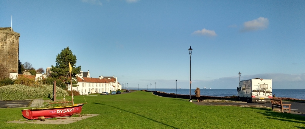
That night lights appeared and disappeared across the Firth, some were boats, some oil rigs and some were Edinburgh, all were mostly shrouded in cloud. The waves crashed against the rocks next to us, drowning out any other noise and we fell to sleep expecting to dream about being in a washing machine. By the morning the sky had run out of rain and the cloud had lifted. We wrapped up and set off to walk west along the Fife Coastal Path towards Kirkcaldy.
The walk took us around the harbour and into Ravenscraig Park which surrounds the castle of the same name. The castle sits on the edge of Kirkcaldy which isn’t mentioned in our AA book of Scotland at all. The book is also unusually organised alphabetically as opposed to by area – if you’re ever writing a guidebook, that may seem like a good idea, but it’s really not great if you want to find out what is around you.
We didn’t venture into the town, as we were enjoying the Coastal Path. It took us through part of the Carr’s Flour Mill site, before leading us onto a mile-long sea promenade, which was built in 1922 to relieve unemployment during a period of ‘Great Trade Depression’. As we walked the sun won the battle of the skies and we were soon peeling off layers and wishing we’d worn our sunglasses.
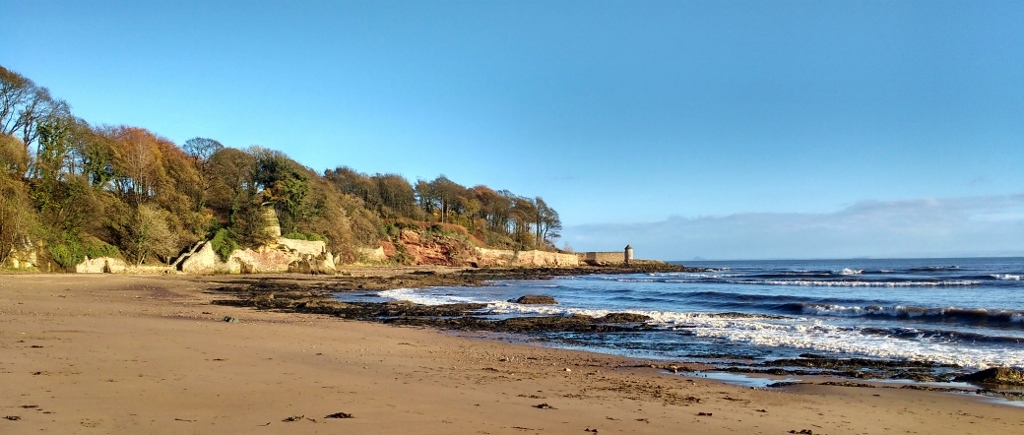
After a couple of hours of walking we stopped off for a bite to eat before heading back along the path to Dysart. The tide was now out far enough for us to take the ‘low tide’ route along the small beach coves. We were joined by lots of dog walkers and groups of nursery school children, wellied up and walking in crocodiles behind their teachers, making the most of the sunshine and autumn colours.
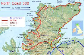
After our walk the maps came out. We thought we had three weeks for our tour of Scotland, which we sort of did, in total. However, having spent pretty much a week getting here, and then another few days waiting for today’s filming, we find ourselves with 10 days before we need to be back home. Would that be enough time to do the North Coast 500 justice? Should we look to do the North East 250 instead? Should we just stay around the East Neuk as there’s loads to see here? Heads were scratched, satnav drive times consulted and finally we decided to go for it. It will mean driving every day (a habit we’re trying to get out of), and we know we won’t get to see everything, but it should whet our appetites enough to prompt a return trip sooner rather than later when we have more time.
So as soon as we’d wrapped up our filming this afternoon, we headed north as fast as the variable speed cameras would allow. The scenery just getting here as we passed the Caingorms looked stunning with the trees ablaze with colour. As we neared our stop for the night we had only the moon to light the snow dusted on the hills around us, but we did get a tantalising glimpse of what is to come.
Ju x
")

Ayup you two. it’s lovely round there we have spent some happy hours there. my favourite spot is pettycur bay just down the road a bit. have a great time. john and val