
Running and Hiking Around Nerja, Costa del Sol in Spain
This blog post is about running in Spain, specifically around Nerja on the Costa del Sol, south of Granada. The information applies to a greater extent to walking and hiking too, if you fancy staying active and exploring a little while you’re on holiday in the sun. There are a ton of hikes around Nerja, and this post isn’t meant to capture them all or to give turn-by-turn instructions for any of them. It’s more to give a flavour of the walking and running opportunities away from the coastline.
Why Nerja?
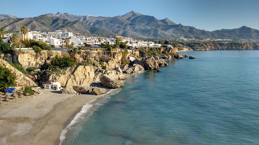
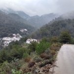
Nerja is located on the Costa Tropical, which has a fantastic climate, arguably the best in Europe with very little rain and daytime high temperatures of typically 17°C to 22°C in January and February. The town is off to the east of the Costa del Sol and is on a latitude comparable with the Peloponnese in Greece, Tunis in Tunisia and Sicily, while being far more accessible to British tourists than any of them (particularly if you’re driving a motorhome like us).

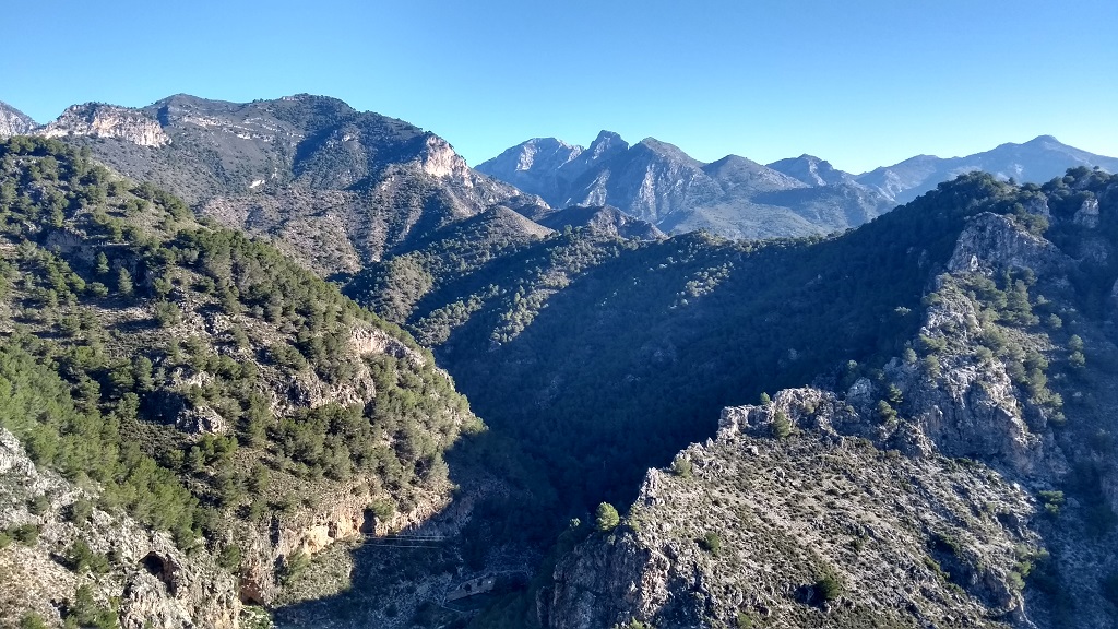
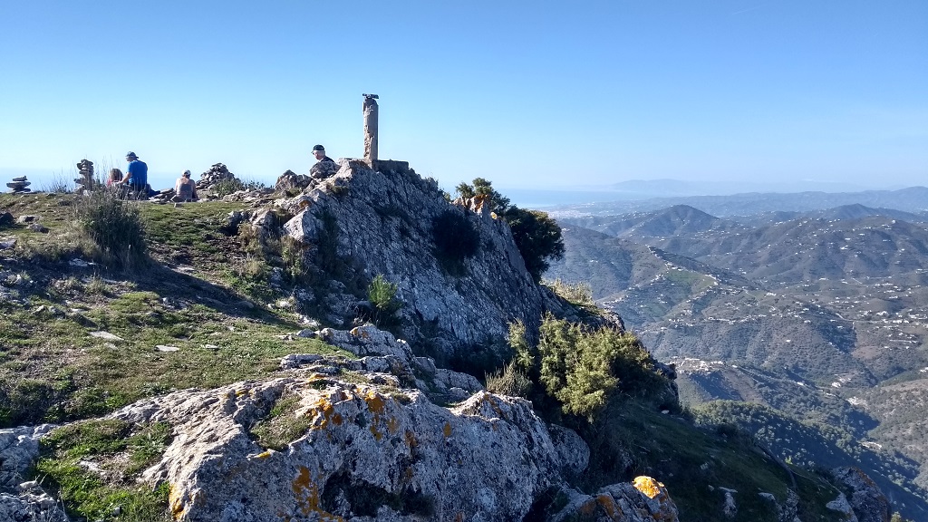
Driving a car or motorhome, Nerja’s relatively easy to get to from the UK by taking an overnight ferry to Santander, and then using Spain’s empty and free motorways to drive south past Madrid. A flight into Málaga airport from the UK is roughly 3 hours, from where you can grab a hire car and drive about 40 miles east to get here. Nerja has plenty of development within and surrounding it, but has a feeling of being less developed than the Costa del Sol area to the west, with a central core of winding streets, small coves right in the centre of town and plenty of life with restaurants and bars busy with Spaniards and us tourists alike. The access to the Sierras de Tejeda, Almijara y Alhama natural park’s a key point for me, opening up trail running and hiking across natural hillsides and up to peaks around 1500m. Higher peaks around 1700m up to about 2000m are accessible if you’ve a hire car, but even the lower ones have expansive views of the coastline and the mountains to the north.
Finding Hiking and Running Routes Around nerja
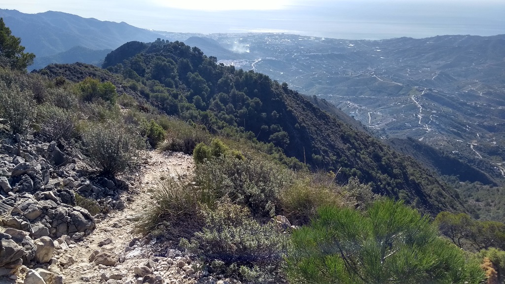
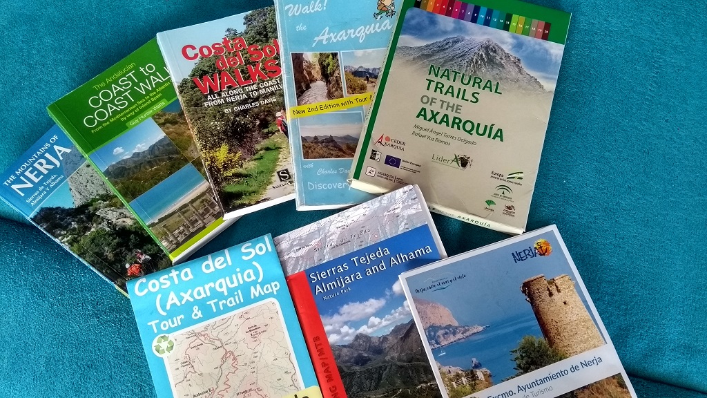
We’ve been using a number of methods for working out hiking and running routes. One of the long-termers on our campsite knows the area very well and has loaned us a number of books and maps, as shown below. Nerja is part of the Axarquía area which encompasses the area to the east and north of Málaga, and many publications have this area in the title. For me the most useful, during our month long stay to date, have been Mountains of Nerja and the Costa del Sol (Axarquia) Tour and Trail Map. As well as providing clear guidance on which paths are the best to follow, the books tend to include wider information about flora and fauna, rock formations, climate and history.
As I’m running rather than hiking, I’m using the books and paper maps for planning before setting out, but then using a smart phone for navigation while out on the trails and paths. I have the free maps.me application which has offline maps and has all the trails drawn out on it, and I use bookmarks to help stay on the correct trail. Maps.me includes lots of minor trails so it’s sometimes hard to pick out which is the one I should be following if I rely on it alone. The app lets me calculate walking routes between bookmarks, and shows the altitude changes along the route, so I can get a feel for the distances and difficulty involved before setting out. I’ve also been recommended the free wikiloc.com website and app, which has user-submitted trail routes across the world and I’m starting to get to grips with it.


Finally there are ‘GR’ (Sendero de Gran Recorrido in Spanish) long distance walking path routes which pass through the area, and lots of information can be found about them online. One example is the GR-249, a few miles of which run through Maro into the natural park to the north and across through the white town of Frigiliana north of Nerja. There’s lots more information at the official GR website.
General Observations on Local Running
Here are a few observations I’ve made as a Brit tourist on running the local area around Nerja:
- Even in January and February it gets warm here! I’m carrying a hydration backpack with one or two litres of water/fruit juice on runs longer than 10 or 15 miles, especially if I’m heading up into the hills where routes can take much longer to navigate and where there might not be any potable water sources available (I saw a dead goat in one of the beautiful-looking water courses – no stream drinking for me). I take food too on the hill runs.
- For safety I’m also wear Factor 50 sunscreen, sunglasses and a cap, and carry a waterproof coat, a silver foil blanket, compass watch, whistle, fully charged smartphone and basic first aid kit. Ju (my wife) also knows the route I’m doing and I tend to send a text when I’m about half way through so she knows all is OK. There isn’t always a signal up in these hills, which is worth bearing in mind.
- Also keep an eye out for signs saying hunting is in progress (caza is hunting in Spanish). I once ran into a hunt south of Peniscola, and caused a bit of consternation with the blokes carrying shotguns, which was unnerving (people are occasionally shot, it’s no joke). We spotted signs for one evening hunt going on on the GR-249, best avoided.
- There are few flat walks and runs around here, it’s hill country! If you don’t fancy the mountains then the choice is to head east or west along the coast. The pavement runs out within a few miles of Nerja in both directions, but I’ve found it’s possible to safely run alongside the road, although I can’t say I enjoy it. For interval training there’s a 800m long flat dirt road along Playa Playazo to the west of Nerja. There is also a running track in the town, but I haven’t visited it.
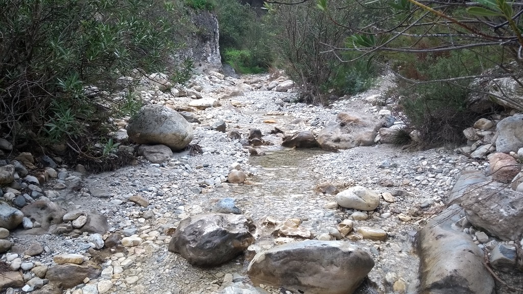
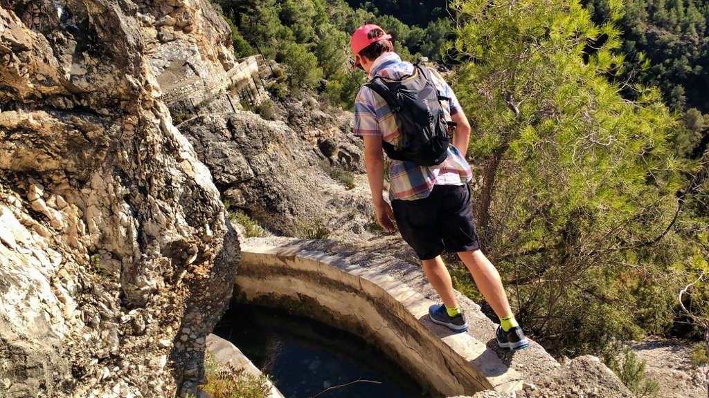
- What counts as a ‘trail’ here can be surprising! The Chillar River route, famous around here, is literally up a small river, so your feet will be immersed for several miles and you’ll be scrambling over boulders too! The path shown on maps.me along the ‘acequia’ to the east of the Chillar is, in fact, a balancing act along a two foot wide concrete edge of a mile-long water trough with drop-offs to the side.
- Many of the official trails through the mountains are single file, some over loose rock and several are unmarked. I’ve not got walking poles so they’re by no means mandatory, but they would be useful on some of the walks, especially the ascent/descent to El Fuerte and El Cielo.
- Spain seems to have a never-ending supply of angry dogs. Mostly they’re contained behind a fence, but not always. I’ve only had one coming-together with unrestrained dogs around Nerja, which was dealt with by me running screaming at the dogs with arms held aloft. This halted their apparently fearless charge and had them legging it, which has been my general experience across Spain and North Africa. If that hadn’t worked I’d have feigned stone throwing. Carrying walking sticks is also a useful defense if you’re nervous of dogs.
- If you’re running rather than hiking, be prepared to walk some sections. I’m OK running uphill at about 6% for the marathon distance, but I couldn’t run up the Chillar (too many underwater rocks and boulders) or the last couple of miles up to El Cielo (too steep/loose rock).
A Few Routes Around nerja
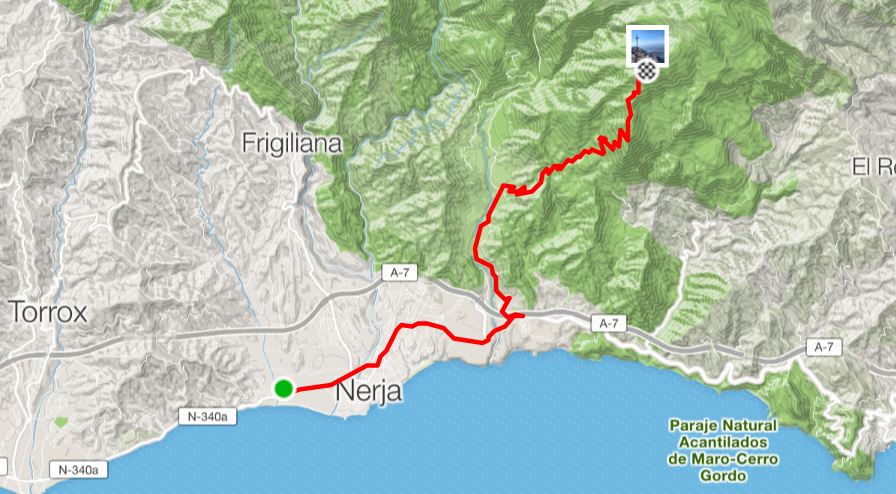
Here are some of the routes I’ve done in the past few weeks. Bear in mind the fact I’m 47, so no spring chicken, but I’m training for a 50 mile ultra marathon at the moment so I’m in half decent shape. All these routes involve uphill walking, with some requiring several miles of strenuous effort and often without much shade and I’m told it gets very hot around here in summer. Please don’t attempt any of these walks/runs unless you’re sure your health is up to it. I have no climbing skills and I don’t much like precipitous drops, so none of the walks/runs below require this knowledge. The map below shows the (very rough) routes for each of the subsequent runs/hikes.
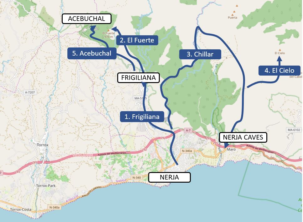
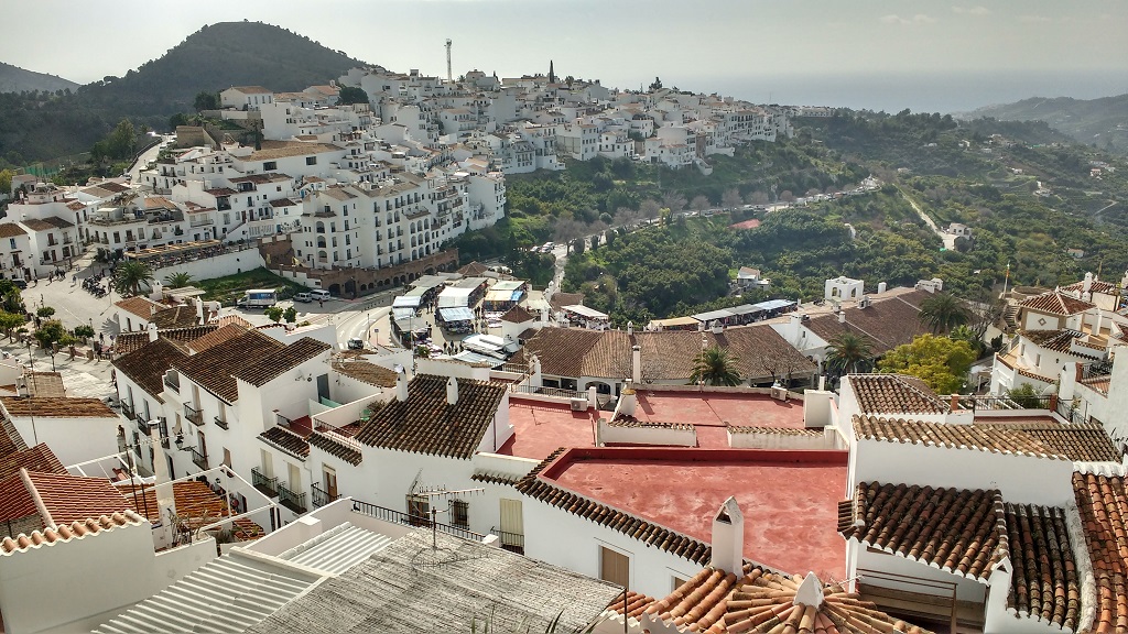
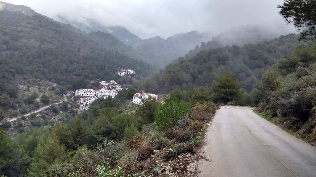
Route 1: The Pueblo Blanco of Frigiliana
Frigiliana is the pueblo blanco about 4 miles to the north of Nerja, voted one of Spain’s most beautiful villages. It’s a kind of standard trip out for tourists in Nerja, many of whom get the cheap local bus (€1.15 each way) up the hill to enjoy the old Moorish village and the views out of the Med. The bus is a good option for making some of the other routes below more accessible, but the run or walk up to Frigiliana is a good effort in itself and well worthwhile, even if you only opt to do it one way.
I’ve run up to Frigiliana along a number of routes, including just heading directly up the road, the MA-5105. That felt safe enough without too much traffic, but there is no pavement or off-road area to run on until you reach the upper section of the road. A more enjoyable and, for most of it, flatter route is to head up the Rio Chillar and Rio Higueron to the west of the road to the village, roughly 4 miles one way, with a total climb of about 300m, outlined below.
I started the run up the Chillar near the car park next to the Mercadona supermarket to the western edge of Nerja, around here: N36.749579, W3.880265. On this walk the dirt road stays above the Chillar and you won’t get wet feet! The road heads under the N-340 and the A-7 motorway. Just after the motorway there’s a small concrete bridge across the Chillar. Turn left up here and another dirt road takes you alongside the Higueron. After about a mile and a half, you have a choice:
- Option 1: turn left up the steep concrete road which takes you to the MA-5105. From there you can walk off-road up to the village, definitely keeping your feet dry but using your camera less than option 2. Here’s the map for this option on wikiloc.
- Option 2: continue straight on up the Higueron. The sides of a gorge quickly close in if you do this and the path starts to criss-cross the small river for a mile. This is an interesting route, with a ton of stepping stones and the odd section of barrier-less man-made steps to use. It’s picturesque but you’ll need to be sure-footed to come this way (the route may also be impassable after heavy rain – I don’t know)! After the mile’s up another concrete road appears to the left, again steep, which takes you right into the middle of Frigiliana. There’s a drinking water fountain at the top of the ascent.
Once you’re in Frigiliana, as well as the obvious option to walk around the town’s old twisting and narrow streets, there are walks to beautiful viewpoints above Calle Real which are worth taking a look at if you have the energy. This is also the starting point for the run up to El Fuerte (Route 2 below).
Route 2: The Last Line of the Moriscos on El Fuerte
After the Christian Kings re-conquered Spain, taking it back after several hundred years of muslim rule, they gradually increased persecution of any of the moors who remained behind. Eventually things came to head and the moriscos (the name for the moors who chose to remain in Spain) were driven to open revolt. The El Fuetre (the strong) mountain above Frigiliana was a final standing ground for the local moriscos in a subsequent battle to put down the revolt, with some accounts talking of moriscos jumping to their deaths from the mountain.
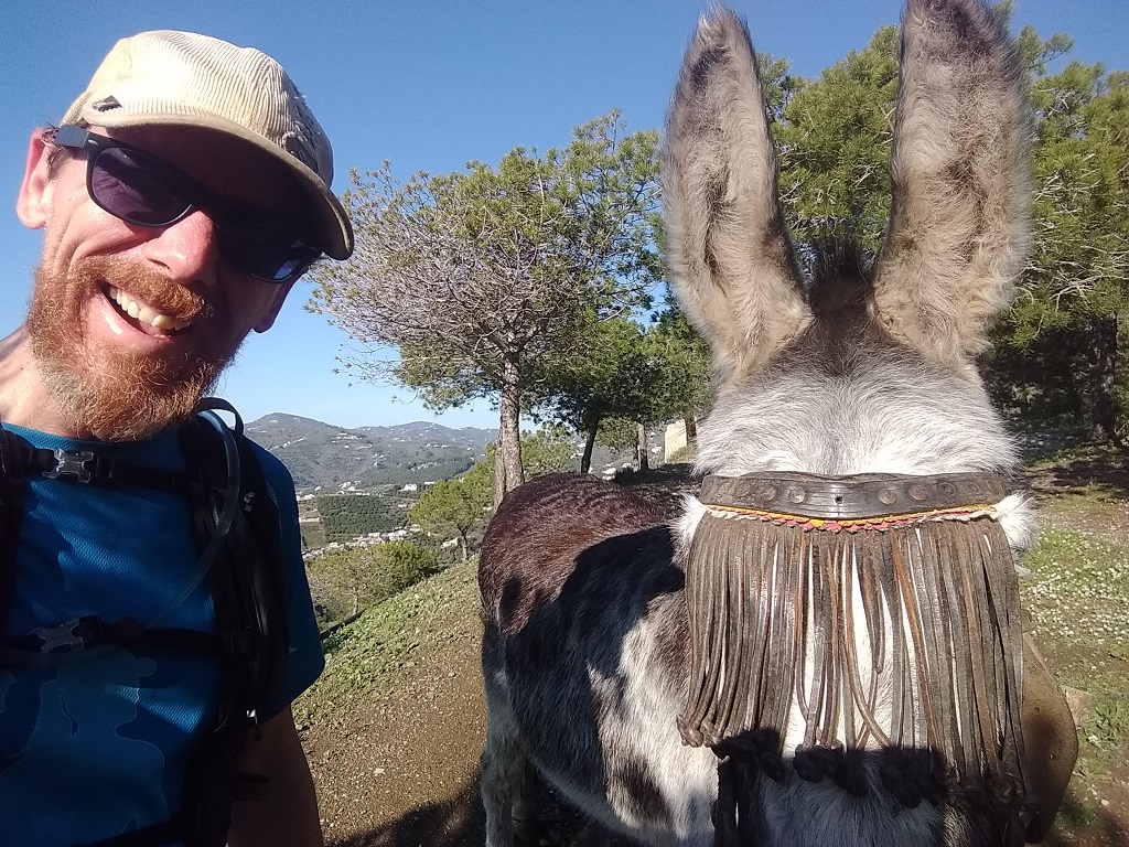
Today, as back then no doubt, the views along the 2.5 mile path (about 700m of elevation) and from the peak itself are wonderful in good weather. The main problem I had was finding the start of the path in Frigiliana! In the end I headed up Calle Hernando El Darra and took the steps up to the right, finding a path which shortly turned back in itself as a steep dirt path and past a couple of friendly donkeys. I also had a moment of doubt a few hundred metres further on, where the path sort of drops rapidly down to a road on the left and straight on past a water reservoir (the Alberca de Lisar on maps.me). From there the path was pretty obvious all the way up to the top.
Route 3: Expect Wet Feet in the Chillar River Folks!
Even though a friend of of ours did this walk the day before we did, and even though he showed us his photos and explained it, we didn’t quite get it. Put simply, you’ll be walking up a small but very bouldery river folks. Your feet and lower legs will be wet for several miles. Although it shows as a trail on maps.me, local literature makes it clear it’s not a ‘normal walk’ (the locals even have a name for the walk: the Cahorros). It took Ju and I four and a half hours to get from the campsite to the GR-249, which crosses the Chillar (pronounced Chee-yar) on its way to Frigiliana or Moro. Expect this walk to take a fair while, start early and bring food and water – it took us about 7 hours in total, coming back via Maro. If it’s been raining or there’s heavy cloud over the mountains, think about going another day. There’s a good description of the route here on wikiloc, and here’s our blog post about the day of the walk.
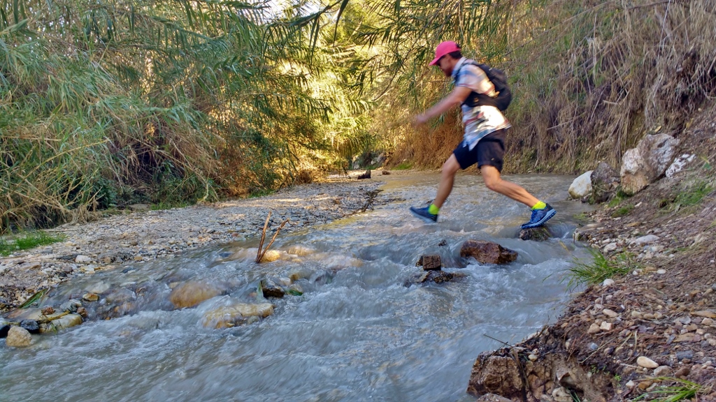
With all that said, this isn’t a death-defying feat, we found out afterwards families routinely do it, especially in the summer! It requires no special equipment other than shoes you’re willing to get repeatedly wet (we wore trainers with grippy soles, flip-flops wouldn’t be great). There’s some clambering over large boulders and umpteen points where you’re fairly certain you’ll end up lengthways in the river but we managed it without falling. The main issue for us was not being sure we were on an ‘official path’ and thinking we must have gone a bit nuts, but it is a ‘proper’ route, just one we wouldn’t expect to find back in Blighty!
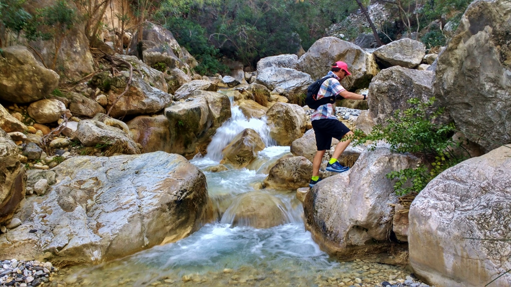
Again the start of the path proved a bit difficult to find, but the best spot is perhaps the one given in Route 1, below the Mercadona supermarket. From there it’s straight up alongside the Chillar, under the A7 motorway and keep following the water until you find yourself in it! There are lots of places where a small path has been made to bypass obstacles like waterfalls, and we found ourselves frequently backtracking if we missed them and couldn’t find the way. At a couple of points the gorge closes in and you can walk with one hand on each wall of rock through the river bed. It’s quite a ‘path’, and if we’re honest we got a tad fed up with the constant splashing about and struggling to find the way. Our enjoyment wasn’t helped by us not having a good understanding of what we’d taken on and having started out too late in the day, so we were worried about losing the light.
Eventually we made it up to GR-249, where we took the option to turn right and head for Maro (we could have gone left to Frigiliana and taken the bus back or walked Route 1 backwards – we found that both trail heads are difficult to spot from the Chillar). At this point we made another error, opting to walk down the acequia instead of sticking to the main (longer) GR-249 path. The acequia is a concrete channel which carries water from the hills down to Nerja. It has sides about 2 feet wide and follows an amazing path along the contours of the hillside. The only issue is vertigo. I’m not bad with heights but I’m not great either, and having to balance on a ledge this wide with drop-offs either side for, potentially, miles on end wasn’t making for a fun walk. This wasn’t helped by collapsed fencing at some of the more exposed sections and thankfully we came across another steep path back up to the GR-249 (this page describes that part of the route).
From there the main path was wide and safe all the way down to the Nerja Caves at Maro and onto the 4 miles of pavement back to the campsite. We read afterwards it’s better to do this walk the other way around, so your feet are dry until the later stages of the walk, which makes plenty sense. Another day I ran up to Frigiliana and across the GR-249 to the Chillar, a wonderful trail with great views but I managed to miss the turn from the Higueron valley up onto the mountain section of the GR-249 and I couldn’t find the onward trail from the Chiller back up towards Maro and ended up turning back on myself in a huff (I’m sure maps.me has some non-existent trails around the river crossing).
Route 4: Sky High on El Cielo
After a few weeks of running the trails I was starting to get a feel for how hard it is to run around here and for my own level of fitness, and decided to have a crack at El Cielo. El Cielo means ‘the sky’, and is one of the higher peaks you can see from Nerja at about 1500m. There’s a description of the route up to the top in The Mountains of Nerja, and also a map and description on a board alongside the GR-249 by the Nerja Caves. I also plotted the route out on maps.me, working out it’s roughly a 20 mile round trip from the campsite. That suited me, but the route can be made much shorter by driving/cycling to the Nerja Caves (directions here) or by heading up the dirt road from alongside the Caves to the Pinarillo picnic area, which is sometimes closed to cars in summer.

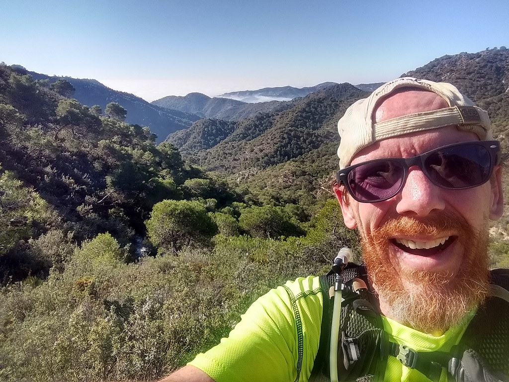
I found I could run all but the last couple of miles of the ascent, which became too steep with loose rock underfoot in places. The path before then was on dirt road, so nice and wide and mostly not too steep with the occasional tough section. The last couple of miles were on exposed hillside, so no protection from the sun, and on single-track path through low undergrowth. One book mentioned snakes up there but I didn’t see anything other than a few sure-footed cabras montes, mountain goats.
The only problem I had with this route, other than it feeling like a tough long drag at the end, was the fact the path became harder and harder to spot towards the top. I lost it three times, each time backtracking or using maps.me (difficult in bright sunlight) to see where the route was and scrambling cross-hillside to find it again (not fun). I’m not renown for my navigation skills mind you, so that could just be me. I also opted to return via the same route I went up (the southern part of this circular route on wikiloc).

On the day I went up I only passed a handful of other hikers, and had the summit to myself. The views from the top were some of the very best I’ve experienced trail running in Spain and compares with the awesome scenery found running the French and Swiss Alps, in my opinion. It’s quite a tough haul to get up there, but well worth it.

Route 5: The Lost Village of Acebuchal
Acebuchal is a small recently-renovated hamlet set on the edge of the natural park to the north-east of Frigiliana. It’s known locally as the Lost Village, as it was left to rot after being forcibly evicted during Franco’s fight against guerrillas after the Spanish Civil War. There are some more details about the village and other echoes of the civil war in this blog post.
Probably the most sensible way to walk or run the village is to get the bus up to Frigiliana and then walk (mostly uphill) the remaining 3 or 4 miles. I opted to run from the campsite up to Frigilina and then onwards (again on the road) Acebuchal, coming back via Torrox and Torrox Costa, but that was 26.7 miles with 3000 feet of ascent (after getting a bit lost) so maybe not for everyone.
The route from Frigiliana is simple enough. I chose to just run up the MA-5105 road, although there is a section of the GR-249 which is probably a much nicer route (it’s here on wikiloc, and described very well here too). I managed to miss the turn-off to the right which takes you to Acebuchal, even though the turn (just before some recycling bins) is well signed by the restaurant in the village! Whoops. From there the route dips and rises, with another turn again signed to Acebuchal and finally the tarmac runs out and after a mile of dirt road the village appears out of the trees to the left. The restaurant in the village gets great reviews and even on an overcast day there was a nice remote feel to the place.
And in Summary
When we eyeballed Nerja on the map before coming here we’d hoped the mountains would prove to be accessible, but they’ve surpassed our expectations. They’re easier to get to if you’re based in the centre of Nerja, as the campsite location adds at least a couple of miles to most routes into the hills. We’re planning to be here a few more weeks and will add any new routes onto this post as we find ’em.
Cheers, Jay


")


")
Such a great post guys! You have included so much information about the area which looks stunning, off the beaten track, slightly hardcore in terms of effort and physical demand, but think I may well give this a go once we are aloud to travel.
Cheers Mike – it’s a beautiful part of the world – highly recommended mate, Jay
Hi Jay , great post , thankyou for your effort 🙏
I am in orgiva atm but heading your way to Nerja more often. Am a keen trail runner . Would love to meet up for a coffee / beer and a if you fancy ?
I would be Chris but we’re back in the UK for the foreseeable mate. Enjoy the Costas fella, Jay