

On the Fast & Free Route North to Redu, Belgium
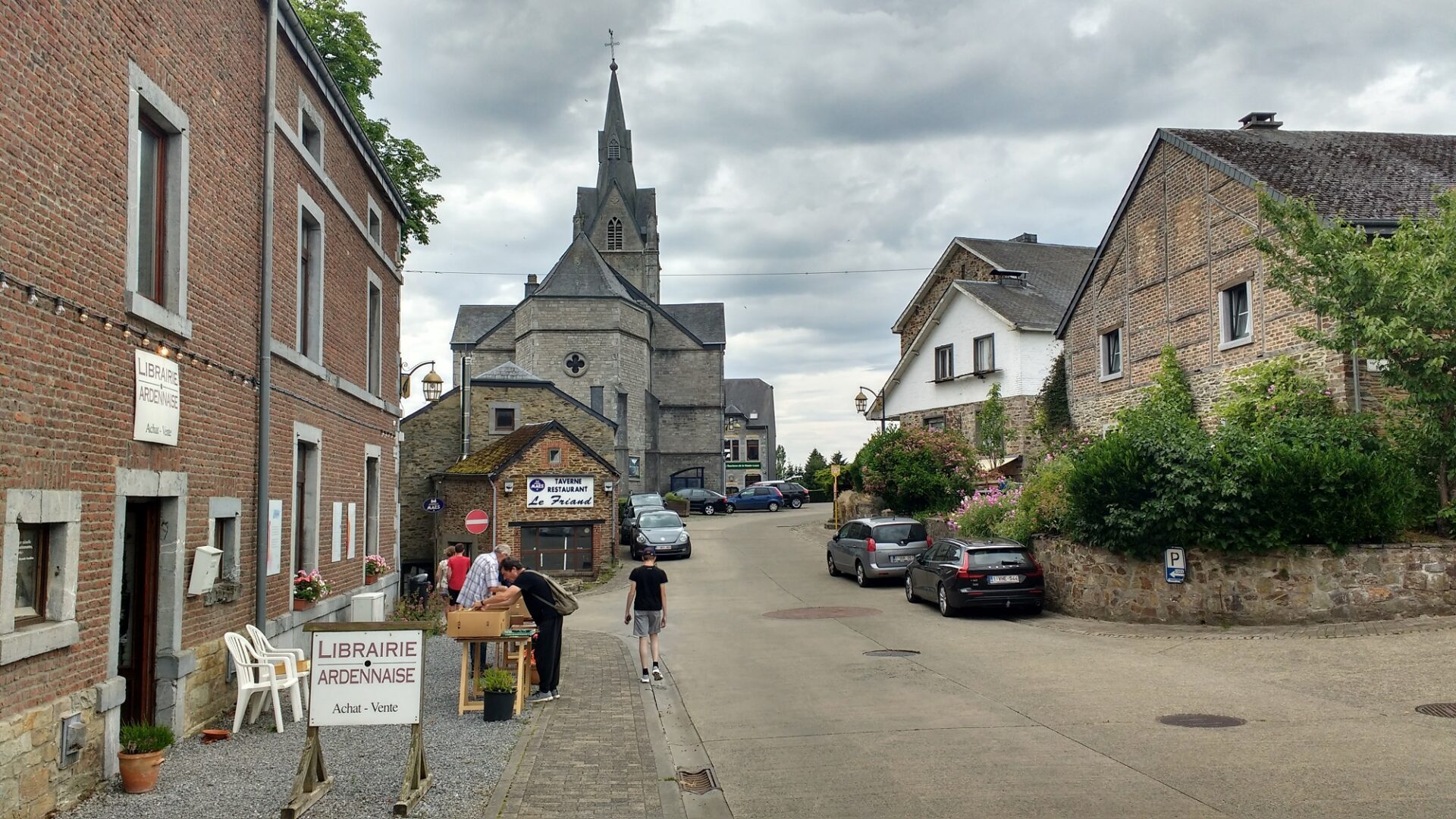
Zagan the motorhome’s sat among the fields and forests surrounding the village of Redu, in the Ardennes region of southern Belgium. The pretty stone and slate village, a well-heeled little place of bookshops and restaurants, has had the rather good grace to provide a free motorhome aire, which we’re currently parked up in alongside two Belgian motorhomes (N50.00870, E5.16349). Thank you Redu!

Being in the south of Belgium, in Wallonia, the language around us is French. The northern part of Belgium uses Dutch, while Brussels uses a mixture of French, Dutch and English. An area to the east, up against the German border, speaks German. This mixture of languages reminds me of Switzerland, or Spain for that matter, and I’ve finally come to recognise the potential strength multiple languages bring to a country. As well as using different languages, various sections of a population also adopt their own aspects of culture and ways of perceiving the world. Having this diversity of thinking within a population adds, I think, a sort of keel to a country’s hull, giving it stability in times of storm, balancing and cancelling out, to some degree, any extreme views. I’d always seen it as inefficient before, that’s my British mindset perhaps, but I’ve changed my mind.
We arrived here after a stop-over at the Vosges town of Saint-Dié, where we stayed for three nights. The town itself is nice enough, with a river running past the aire (N48.28658, E6.96624), woods to walk or run in and shops and restaurants within easy reach. I’ll be honest though: it’s not much of a place to sing about. Back in Nov 1944, the Wermacht (the Germany army, along with Ukrainians and other conscripts), were retreating and with their backs to the homeland were fighting tooth and nail. Saint-Dié bore the brunt of their desperation, with much of the town being deliberately burned to the ground and all the bridges across the river were destroyed. The unfortunates who lived in the town were deported to Germany for forced labour. Much of what remained standing was bombed out of existence by the attacking Allied bombers and after the war the remaining inhabitants found themselves living for years in log cabins. Competing plans were drawn up for rebuilding the town, including a modernist one, although in the end a more conservative approach was taken (as described in this article). Quoting from the linked article, this may have been an opportunity lost (there are a few typos, I’ve left them in):
“All in all the citizens of St. Die wonder now if a great opportunity was missed, it is true that Le Corbusier had radical view but from all other architects , and all other plans that were submited for the reconstruction of St. Die , his plans were the only ones that daringly gazed towards the future , it could have been the dark future that people saw in 1945 or it could have been a spectacular destiny for St. Die . Le Corbusier’s plans may have seemed radical , but his plans were turned also because of the fear of what the future may bring , a future so diferent from the past”

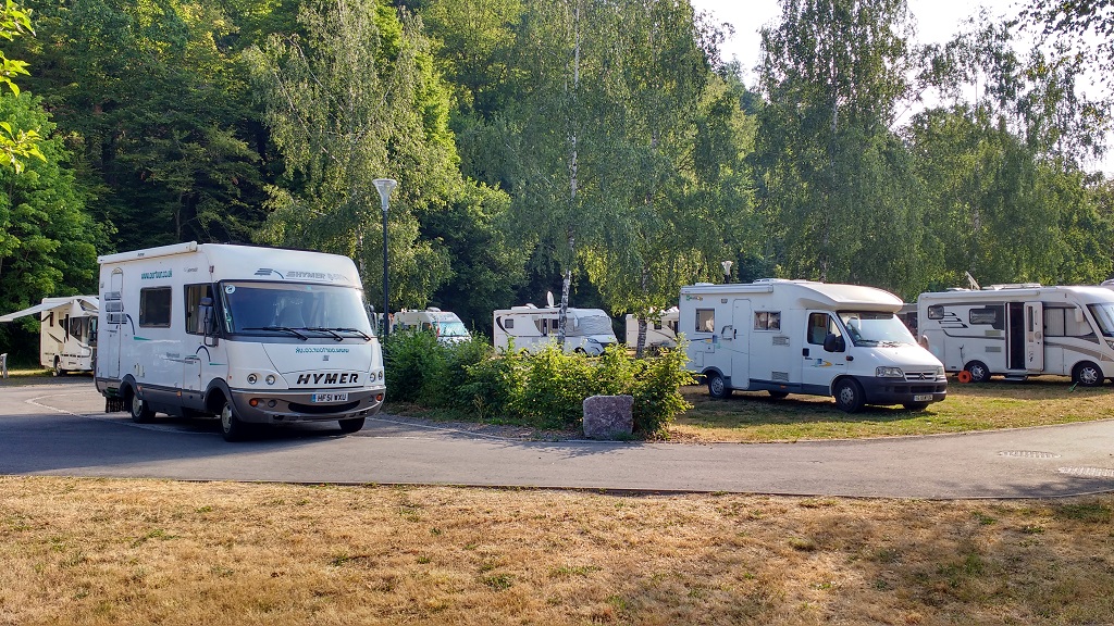
We stayed around for three days largely because the aire was so nice. Located on grass and under the shade of trees, it had quite a relaxed feel about it which we enjoyed. For €6 a night, including electricity, we effectively had access to a simple campsite, and although we made a few forays out to look around, get some shopping (there’s a Lidl and Aldi about a mile away) and do some gentle running, we largely chilled out reading, writing and cooking. I’ve had a cold these past few days, perhaps the aftermath of the Zermatt run, and it’s been good to be able to do little while it sorts itself out.

If you are thinking of heading down to Switzerland, and want to stick to fast roads without paying (much in) tolls, then the route we’ve used long sections of a couple of times is one to consider. All the roads are toll-free until you get to Switzerland (<3.5 tonne = €40 annual windscreen vignette from any petrol station near the border, >3.5 tonne = more complicated process):
- Head to one of the northern France ferry ports
- Use the A16 to head east to Dunkirk
- Turn south on the A25, down past Lille and take the A27 into Belgium
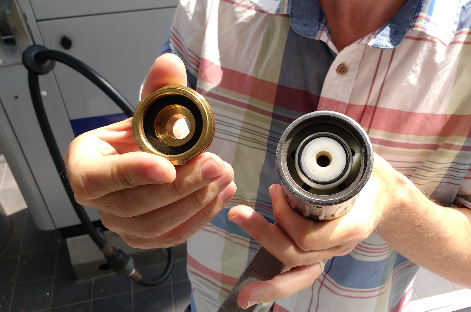
- Use the Belgian motorways to head down into Luxembourg, and top up with low-tax fuel (we brimmed the diesel and LPG today at €1.11 and €0.46 a litre respectively)
- From Luxembourg head south on motorway and fast dual carriageways past Metz and Nancy, all the way down to Belfort
- From Belfort turn east and head into Switzerland under the Jura Mountains
That’s pretty much what we’re doing in reverse, and it’s proving a quick way to cover a lot of ground. Today we’ve crossed a big chunk of France, Luxembourg and part of Belgium in around four hours, and tomorrow we could very easily be at Calais. Our ferry’s not until Monday though, four days away, so we’ve plenty of time to amble north.

Cheers, Jay
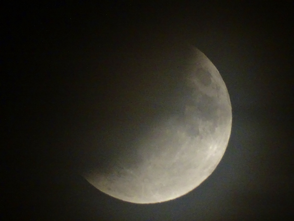
PS. We had a great view of the lunar eclipse at the aire in Saint-Dié, but only managed to stay awake for part of it (well we are an hour ahead over here)!
Hi, you guys are passing my past stumping grounds, bring back some memories!! I loved going through the shops in Redu, searching old maps for my genealogical research! The space center (along the motorway…which now looks a bit taty), my son did a “space camp” a long time ago! And driving down to Luxembourg, you must have seen the signs for “Leglise”…We spent some 15 years of our life in one of the villages of that commune!
On our last trip, in June, we spent our last night in a nice camping 30 min drive to Calais ( Camping St Louis RXQG+57 Autingues, France) I recommend it.
Cheers (from sunny Ireland)