

The Giant of Provence: Mont Ventoux by Motorhome
Two days back we decamped from our shady pitch set on terraced woodland just above the cool waters of Lac de Serre-Ponçon. It had a beautifully relaxed feel and we spent our days reading, cooking, splashing around in the lake and just kicking back, doing nothing much. Although it’s hot and sunny down here, we’re close to the end of high season now. After eight weeks off the kids of France go back to school next week (cue whatever the French for ‘boo, hiss’ is), and everywhere seems to be quietening down (hooray!).
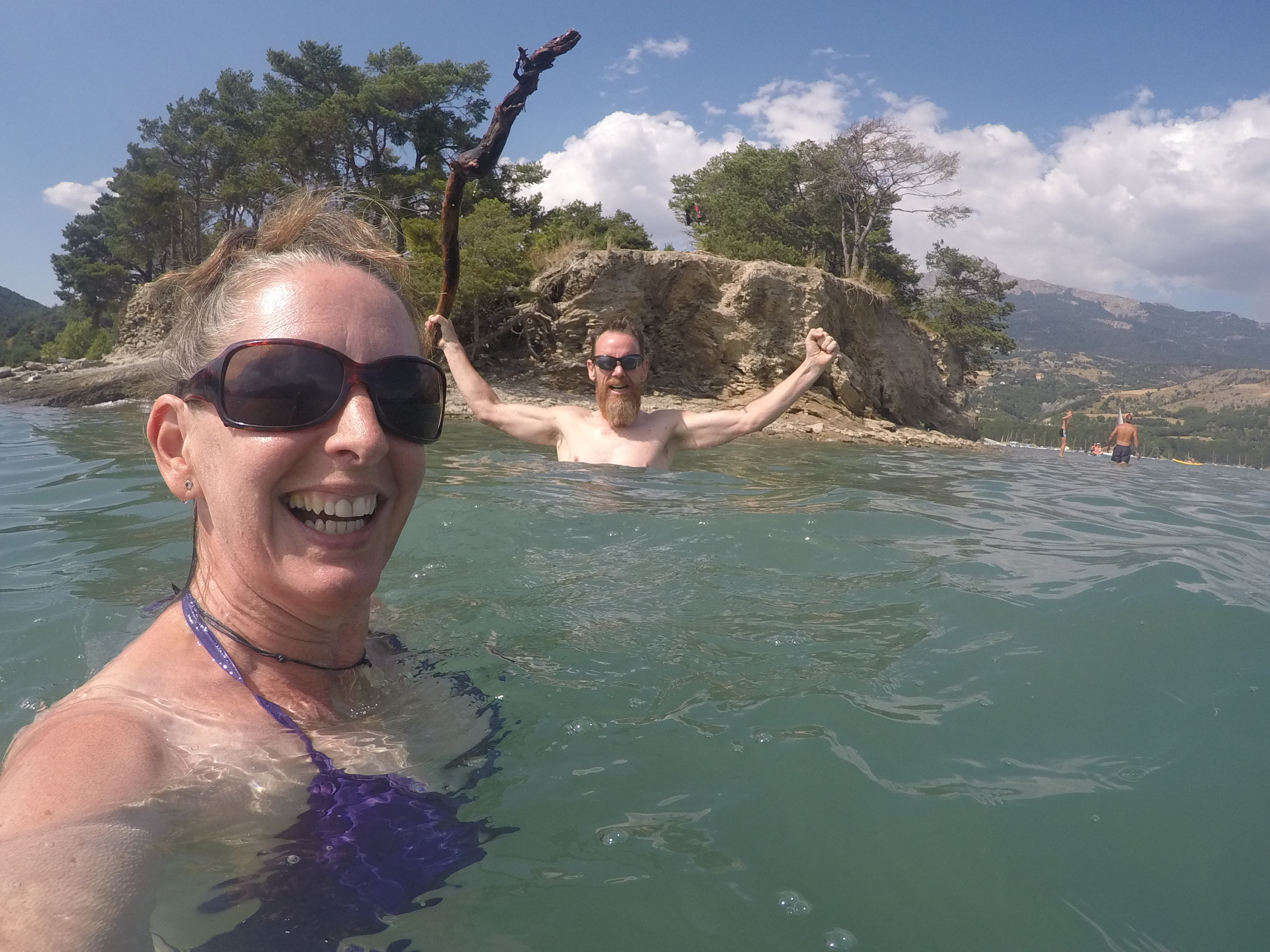
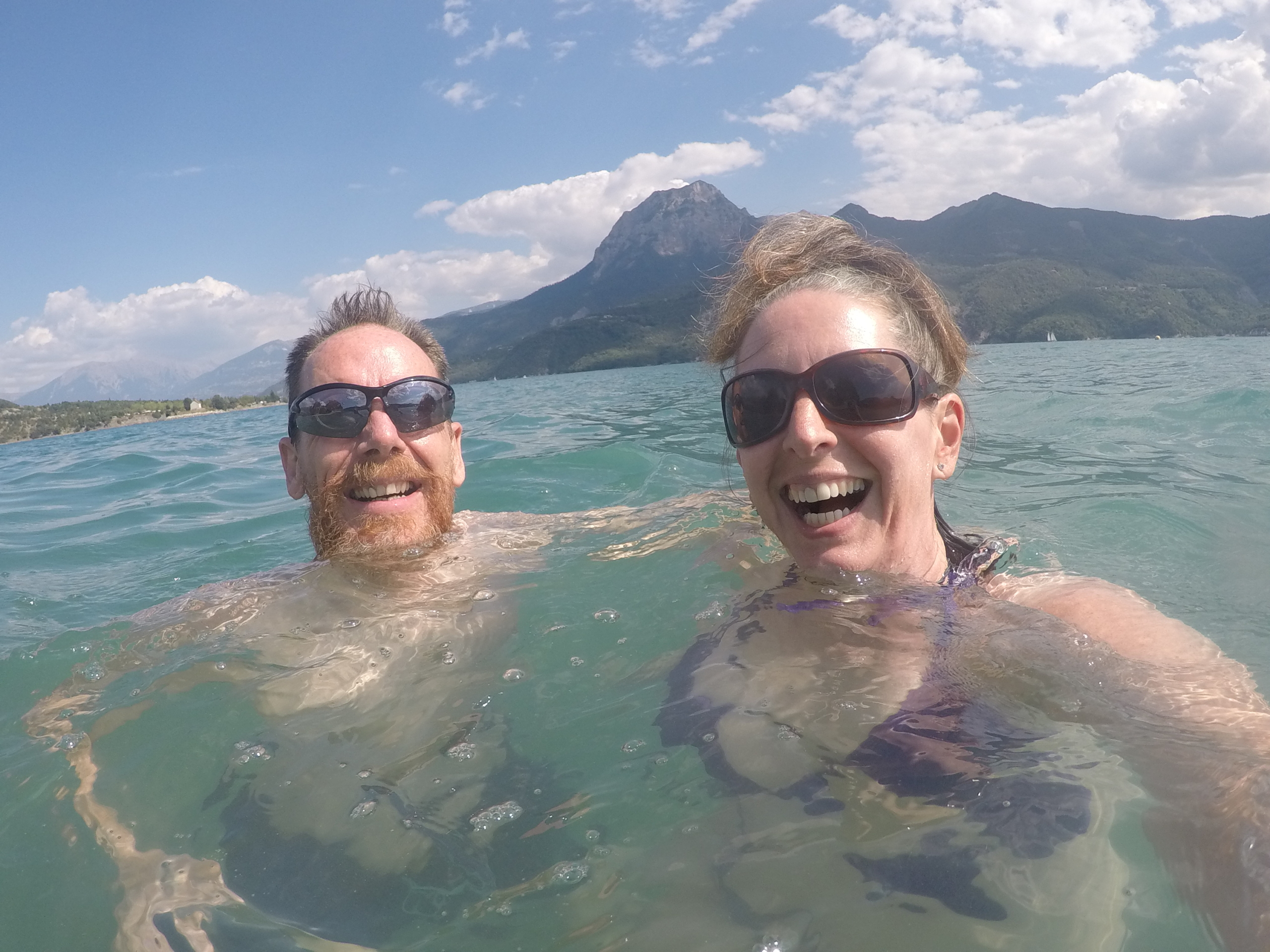
The lake, by the way, is artificial. It was created by damming the Durance river back in 1959, calming the river’s tendency to periodically wash everything away with dramatic floods, creating a huge reservoir to irrigate Provence and generating oodles of power with hydro electric plants. It also created an enormous aquatic playground. Whatever floats your boat, it’s happening, from inflatable assault courses to rental pedaloes. It’s also a beautiful turquoise colour, backed by treelined slopes above which great hulks of rock rise into the sky. Not a bad spot, and we could have happily stayed longer.
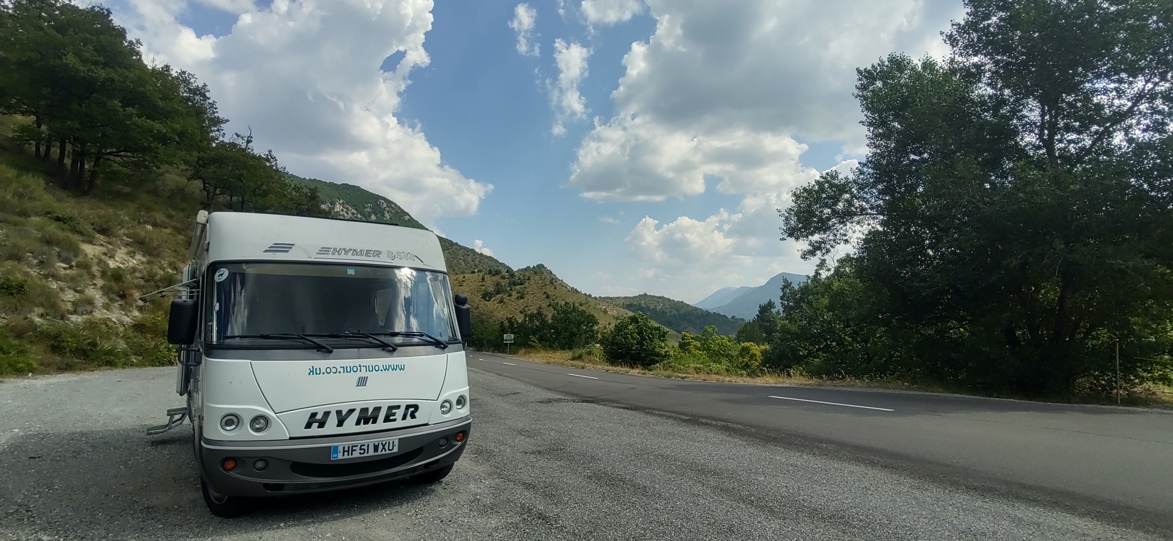
We had more ‘fun’ departing from our pitch than we’d wanted, as the site really isn’t built for motorhomes. It’s on a decent slope, and there’s limited room to manoeuvre between the trees. In the end we escaped with Ju stood outside the van shouting something along the lines of “just go for it, I’ll see you at the top” as I chewed gravel and floored it up the hill. All good, we were off, and we had Ventoux in our sites (well, on our satnav).
I’m weird, I know, and have fancied running up Mont Ventoux for a few years. The mountain’s famous for grueling Tour de France ascents, as well as for simply being quite an astounding lump of rock. It rises high above the medieval villages and lavender fields of Provence, and has long fascinated humanity. We drove up here an age ago in Dave, our first trusty Hymer, and memorably had to stop part-way up to waft his aged overheating engine. This time we planned in a large gravel parking area about 6km from the top, suitably far for a decent run and high enough to get some cooler air from the hot valleys below.
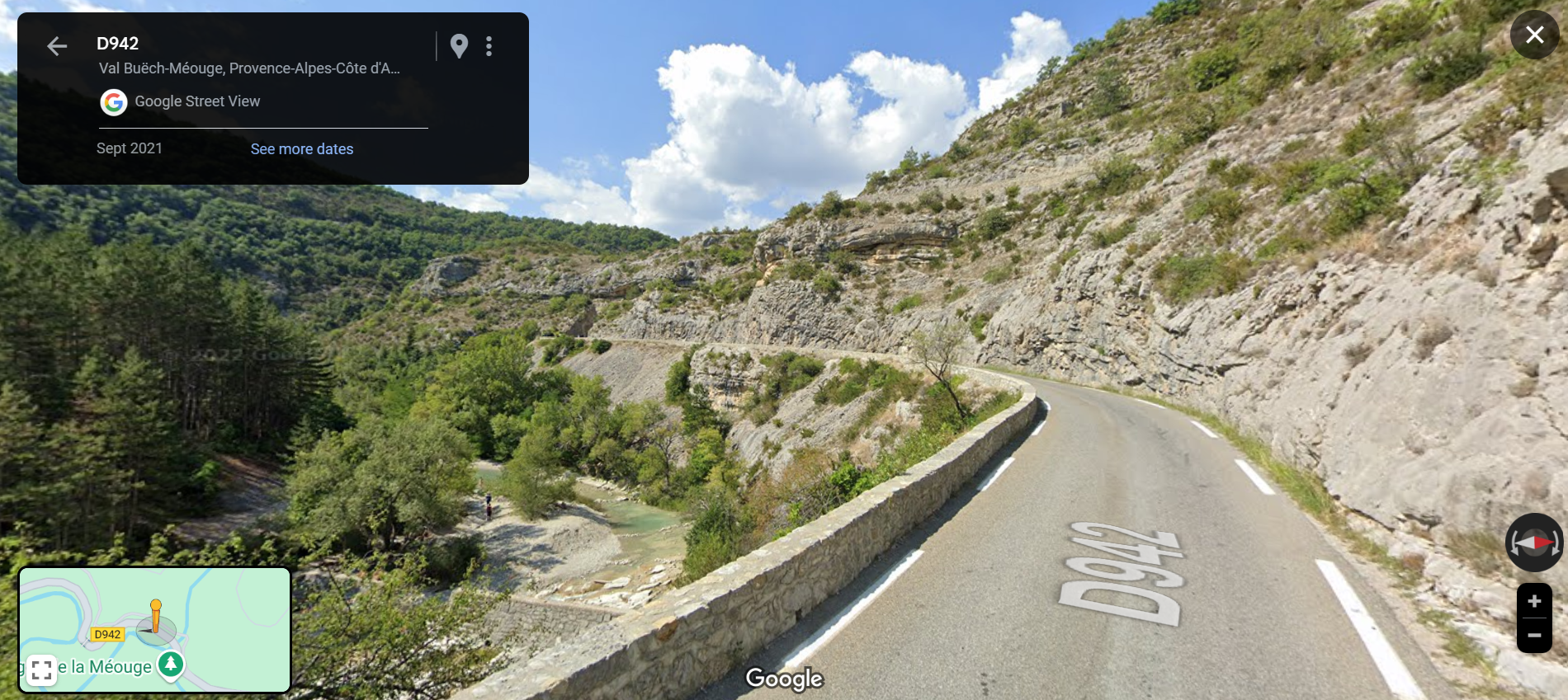
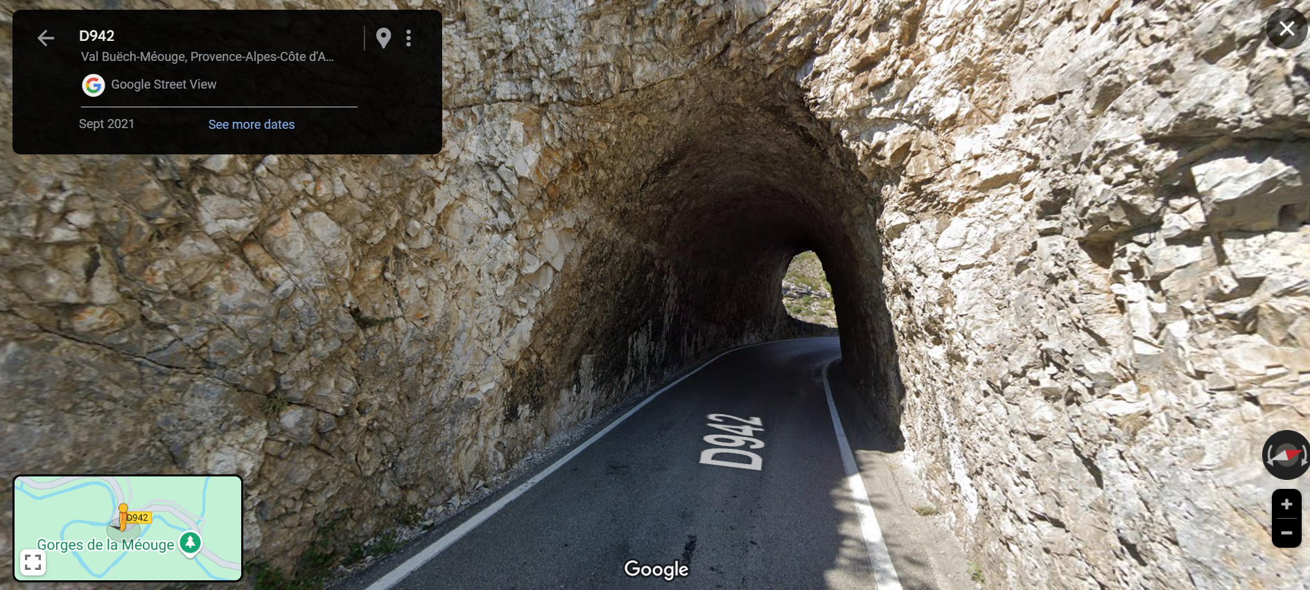
Also, for once, I’d done some research on the route. Google Maps would have happily sent us across the D942 through the Gorges de la Méouge, but the name plus a bit of streetviewing revealed it’s along a river gorge. It’s one of those roads with a great view, but at a cost. The cost being back-ache induced stress. A possible need to reverse down a single-width road with a cliff up one side and a drop to the river on the other. And that went on for miles on end. Nah, we opted for the almost-the-same name D946, which turned out a good choice (our cheapie truck satnav suggested that route too).
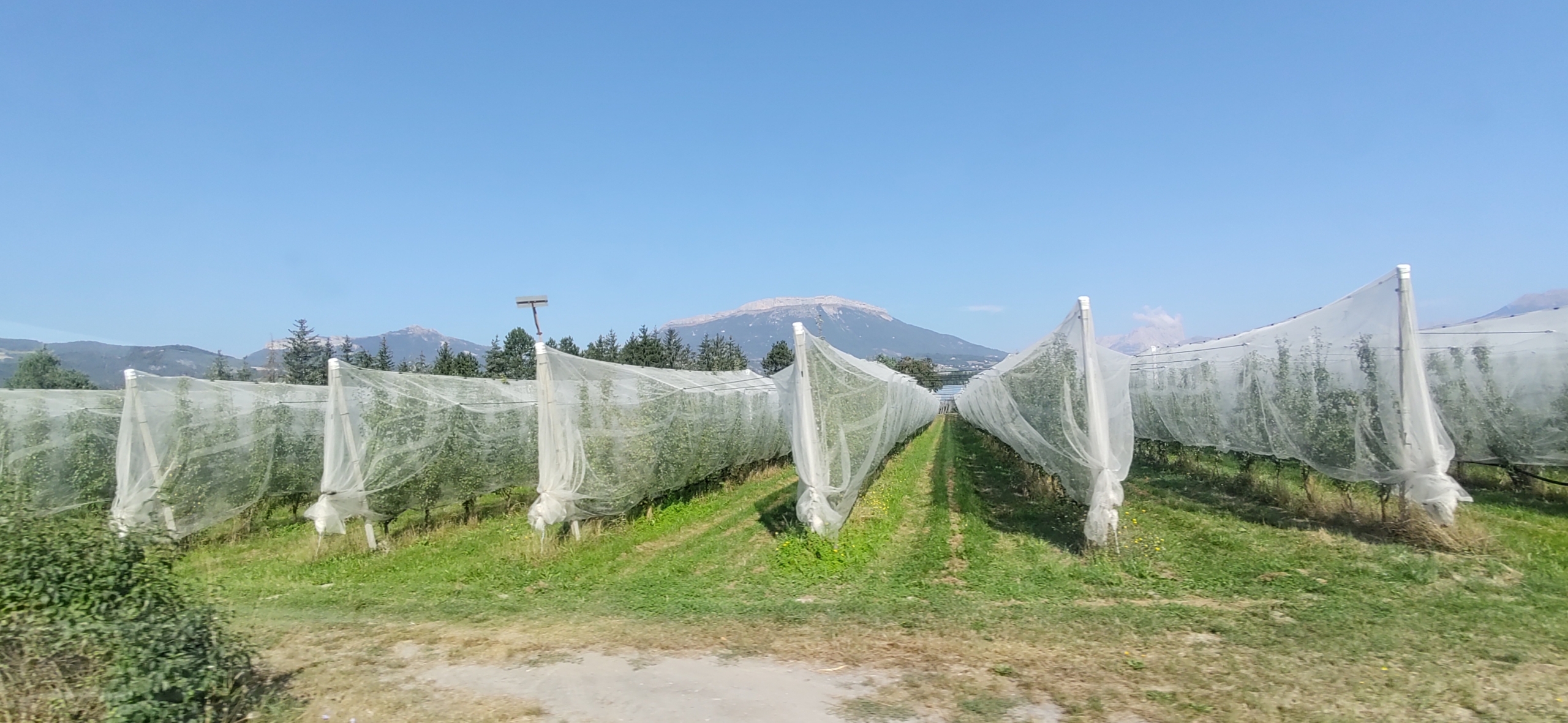
We’d also decided not to bother using the toll road on this section of our tour, as our satnav showed the times were much the same using the parallel N road. Another good call (maybe I’m finally getting the hang of this?) as we flowed quickly south past a gazillion orchards growing ‘Pommes des Alpes’, a variety of apply we’ve never heard of. They sound expensive.
After a nip into Lidl at Sisteron for a stock-up and brimming our tank with €1.59 diesel (the cheapest we’ve seen in ages), we took to the D roads. As we passed through the centre of Sisteron, we marked it on our map to visit on another trip as it looked lovely, but it was too hot to do any sightseeing.
Google Maps had shown we’d be driving past fields of lavender, grown in scenic rows of bright purple. When it’s flowering that is. Which happens around July/August time, but clearly you need to time your run carefully, as every single purple patch had gone, replaced with dull green rows.
We also found ourselves passing signs pointing off to villages–perchés, perched villages. These are apparently very scenic, set high up and in easily defended positions. They look worth a visit another time, but also look small and tight. Not ideal in a lumbering mohowagon and the sun flowing in through the cab windows slow-cooking the life out of us. Even some of the towns and villages we passed through along the main road were a bit tight, although there was nigh-on zero traffic knocking about most of the time.
After a roadside lunch stop, watched wearily by a few understandably lethargic horses, we took again to the twisties and chalked up the remaining miles to get to Ventoux. Yep, twisties. Provence ain’t flat and even before we got to the mountain we’d a fair few hairpins to navigate. Nothing particular difficult, just time consuming as you’re forever slowing down, turning your head to look back on yourself and swinging the steering wheel around.
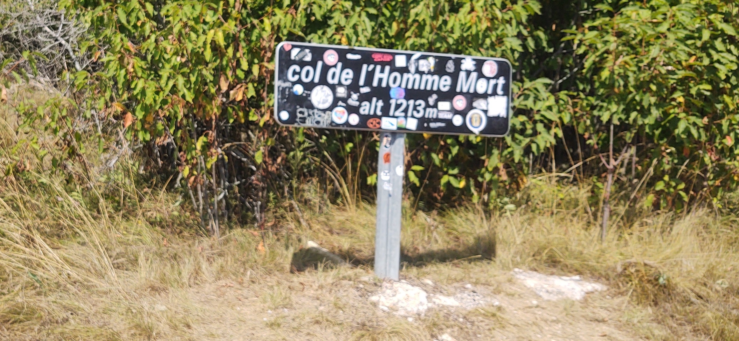
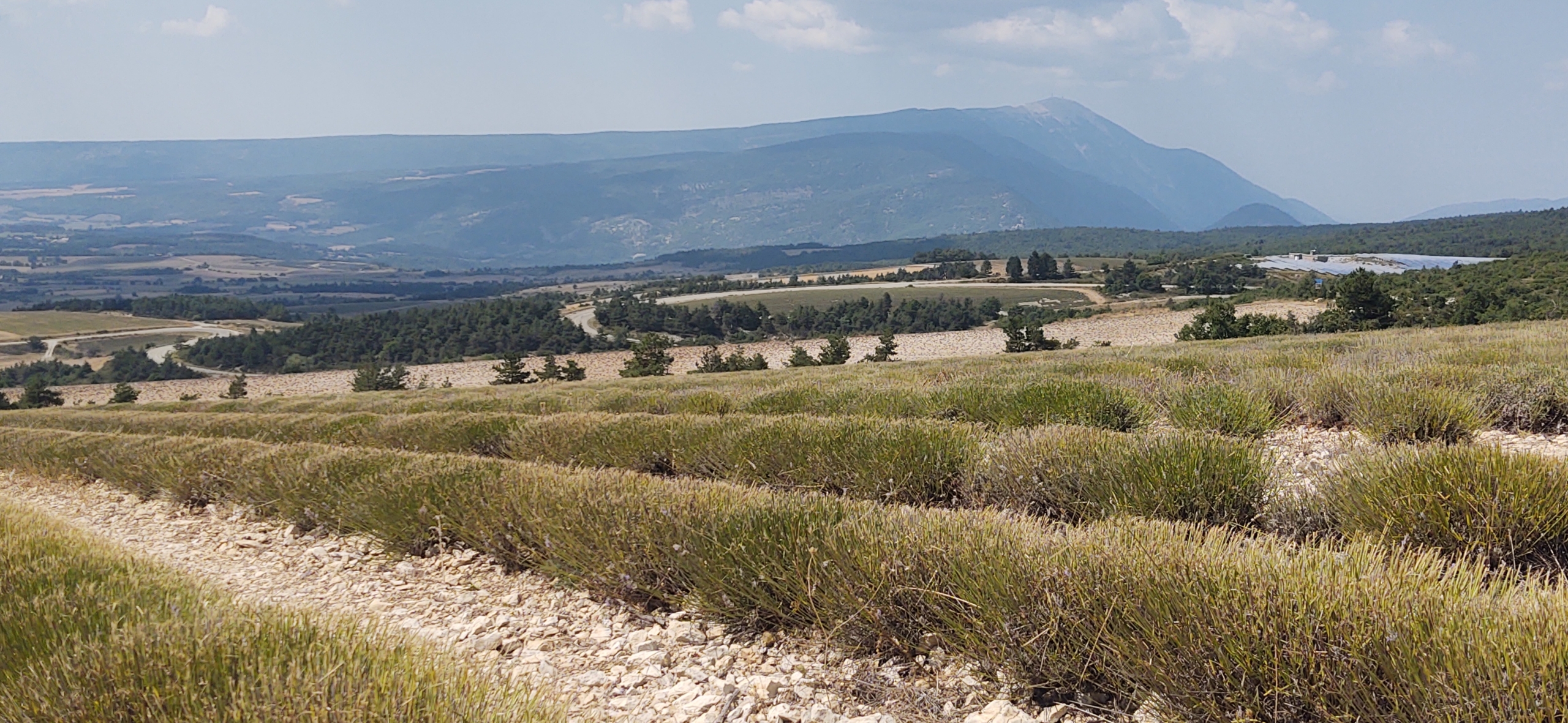
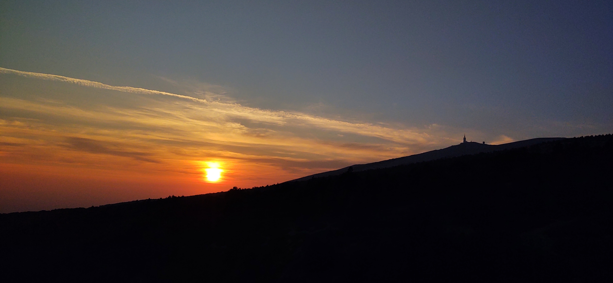
At one point we spotted a sign showing we were heading for the Col de l’Homme Mort, The Dead Man’s Pass, a little unnerving. No worries, it was an easy road and just after we drove past the Col sign we pulled into a viewpoint. Mont Ventoux towered over the fleeced lavender fields, an almost ideal Provence vista.
Ventoux itself is easy to drive up from Sault. The tarmac is wide and in perfect condition, with a cycle lane marked out on the right. Although the ascent is long and steep, traffic was very light and it was no challenge for our van. Yep, the temperature gauge crept up above normal, but no need to stop and waft this time. The big gravel parking area was where park4night said it would be, about 6km from the top just above the tarmac car park of the Chalet Reynard cafe, and in we pulled along with a couple of other motorhomes. A few small panel vans arrived later on. It was a fantastic place to spend the night in semi-wilderness.
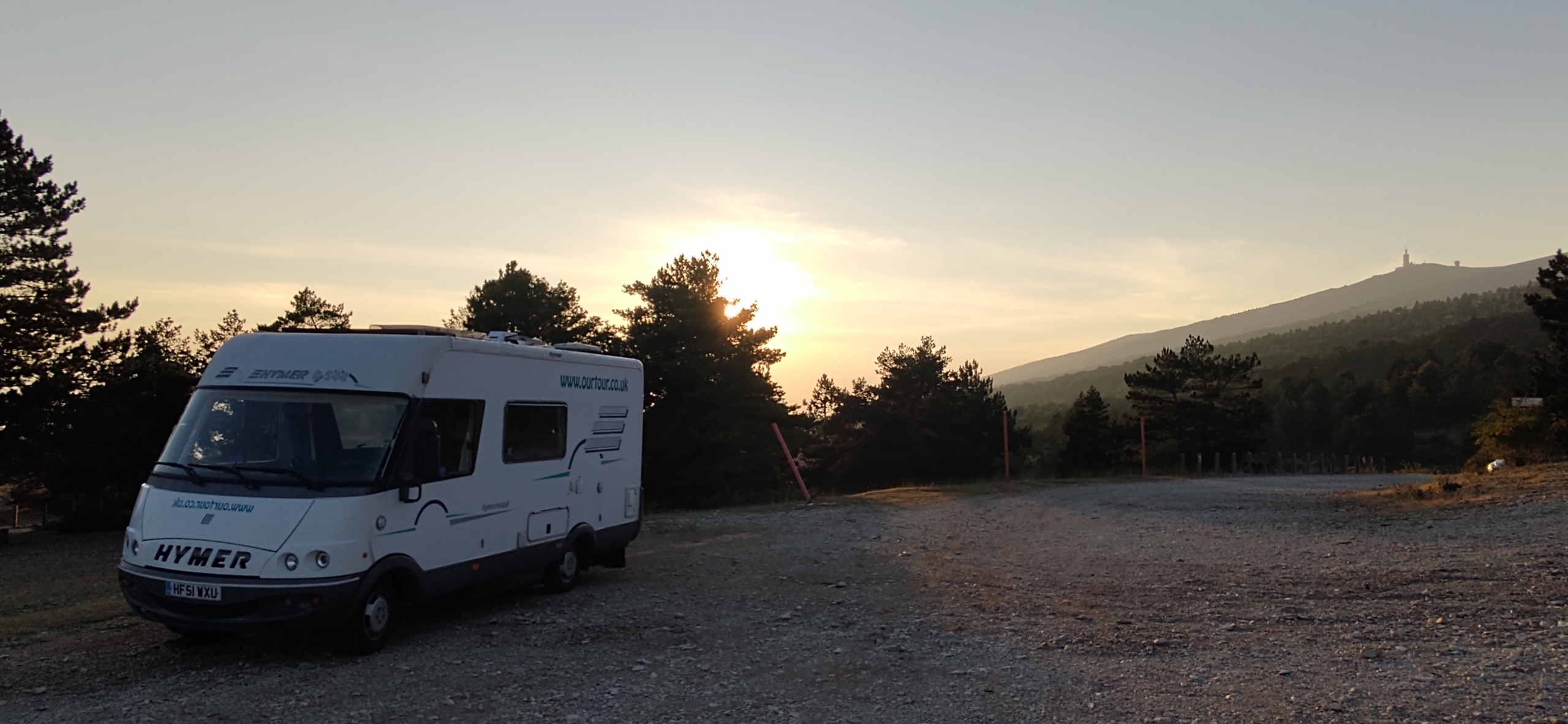
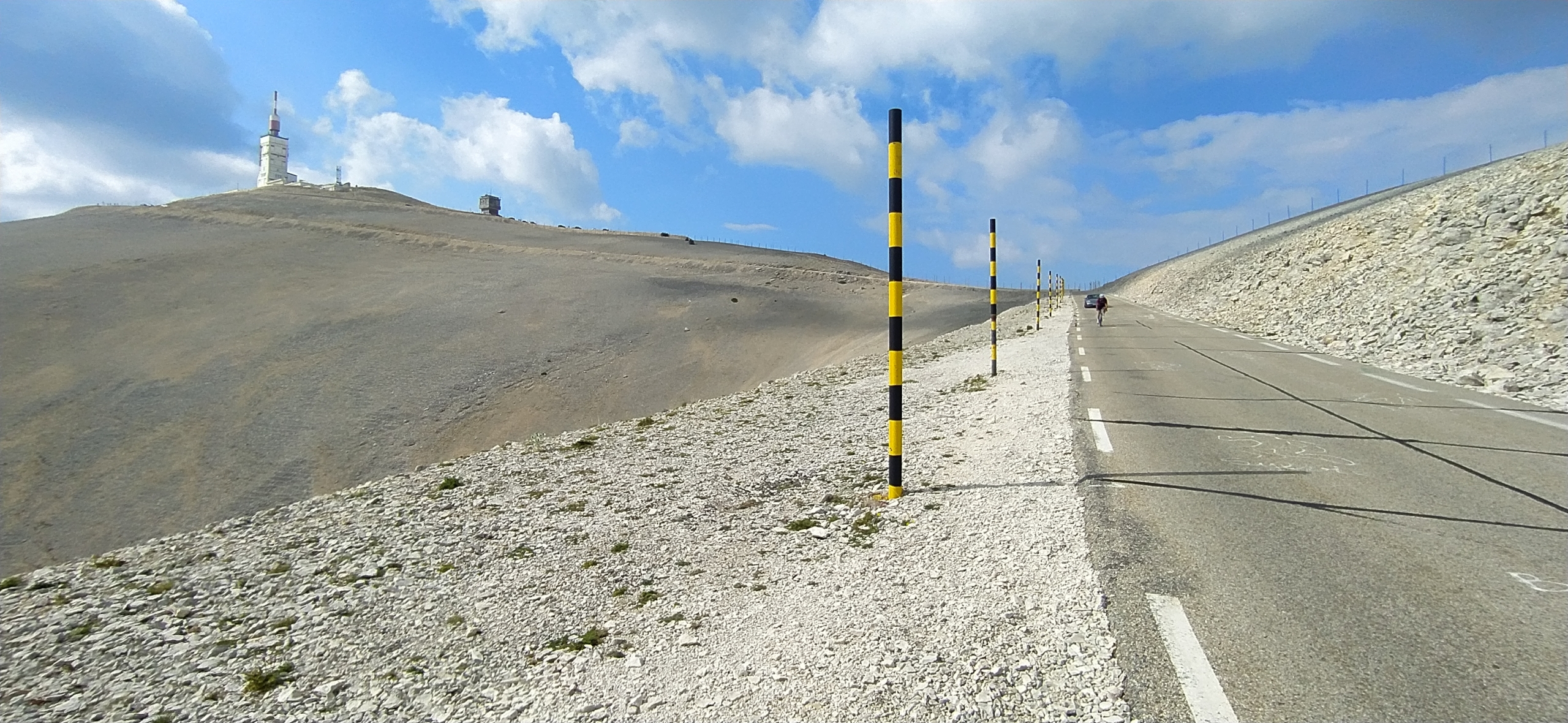
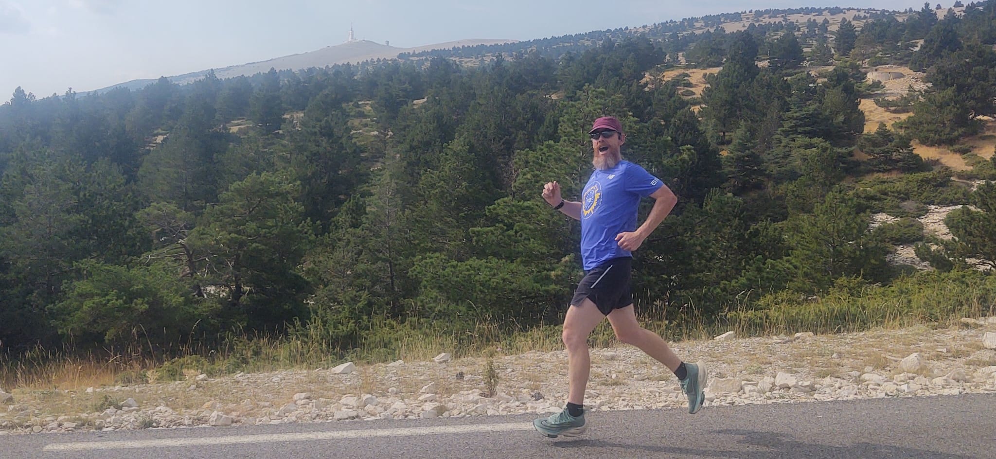
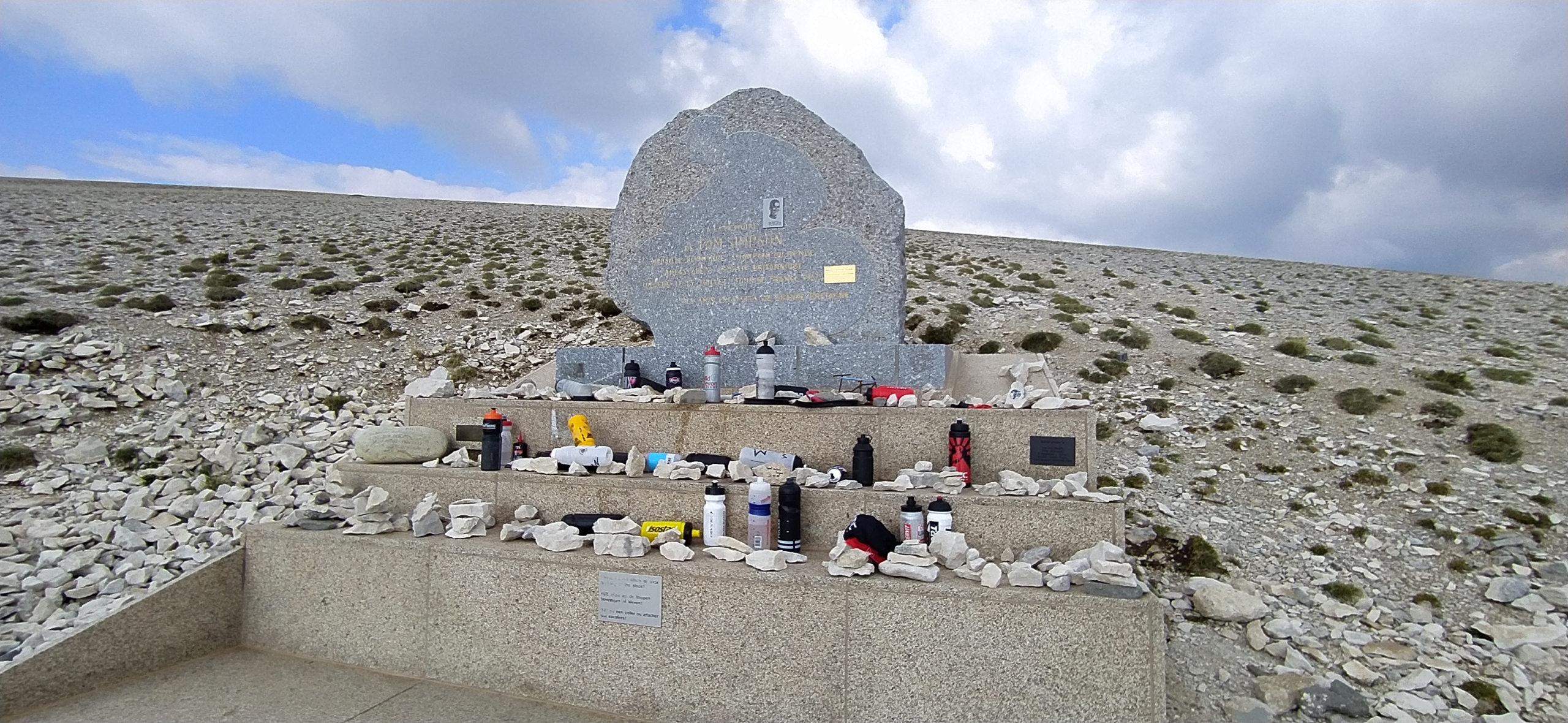
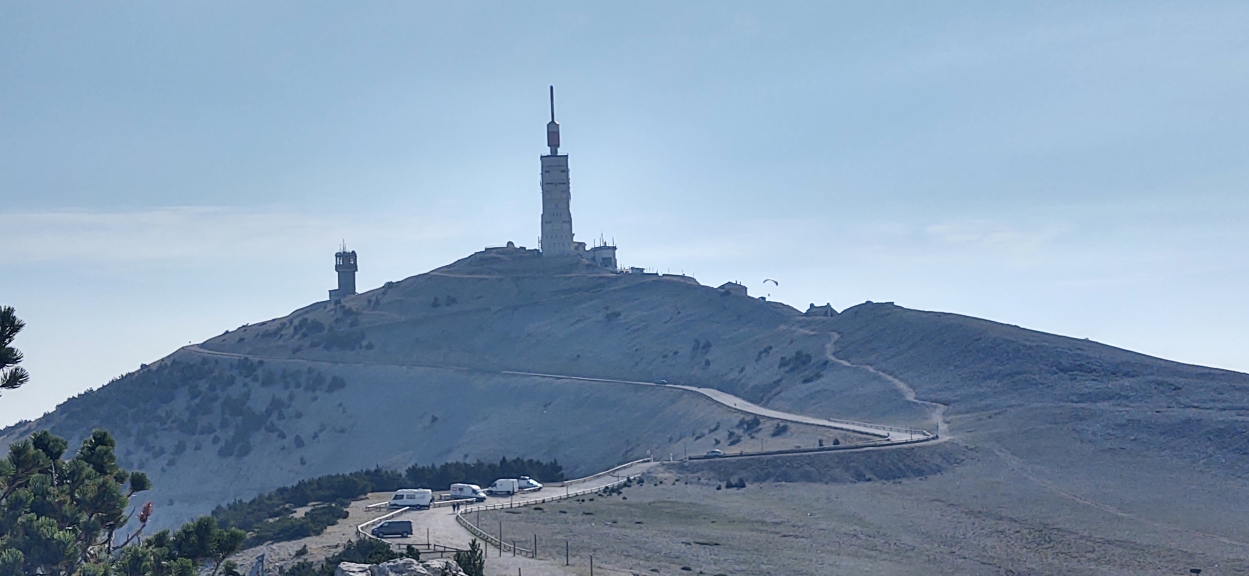
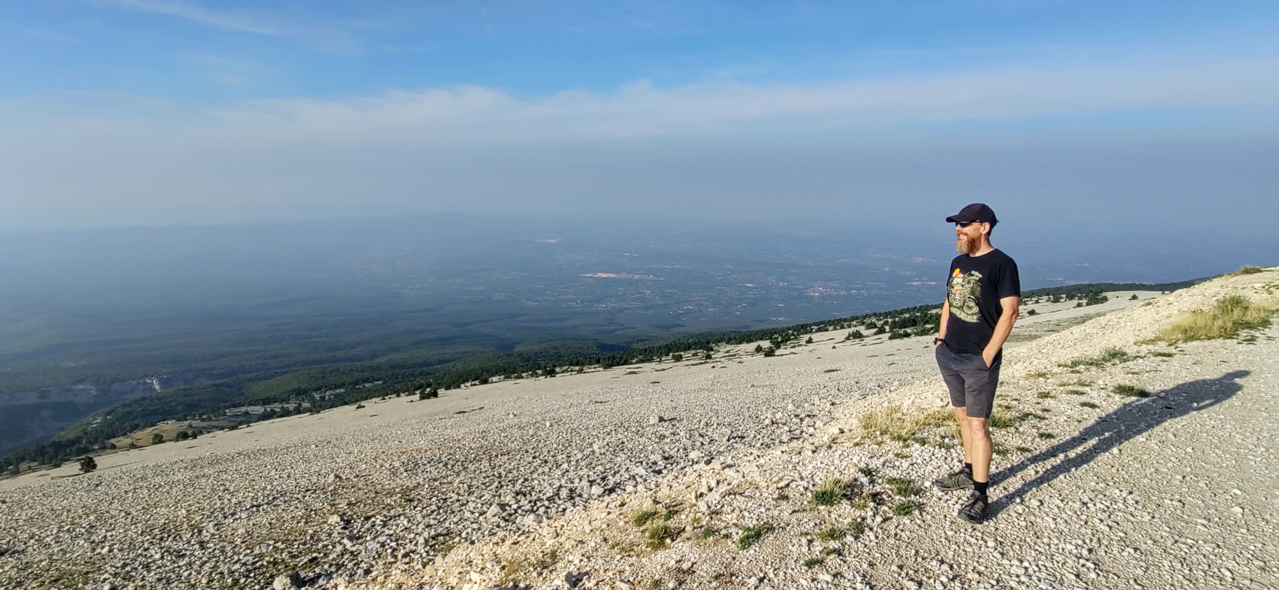
From down here we could see the top. Famously Ventoux has no trees anywhere near the summit. They were cut down in the 12th Century for shipbuilding wood (it was floated down the Sorgue river to Toulon) and to clear land for sheep farming. These days the last few miles of ascent are through a moonscape of cracked and broken grey rock. It’s quite a sight. After getting the van level I pulled on my trainers and jogged up to the top.
The cyclists ride at least 13 miles uphill to the top which I only did the last 3.5 miles or so, but I was still relieved to make it to the top without stopping. It’s a hot, steep climb on an August afternoon, my heart rate was cranking towards maximum. Chapeau to the legions of cyclists who make it up there every year, never mind the incredible Tour de France riders who actually race up the monster.
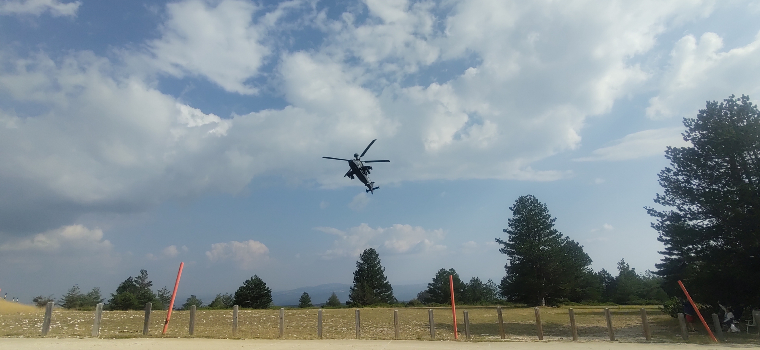
Back at the van Ju had headed out up the road to grab a photo of me. She was accompanied by a friendly, matted-fur pooch which she realised was guarding the sheep whose bells were playing out across the mountain side. We looked up why a guard dog might be required. Wolves. There are wolves up there. While that’s fantastic for nature, it made our star gazing forays outside later on a little furtive! A helicopter gunship also gave us cause for excitement when it came in low over the mountain side, hammering over the van, before winging around for another run. Odd stuff happens on motorhome tours.
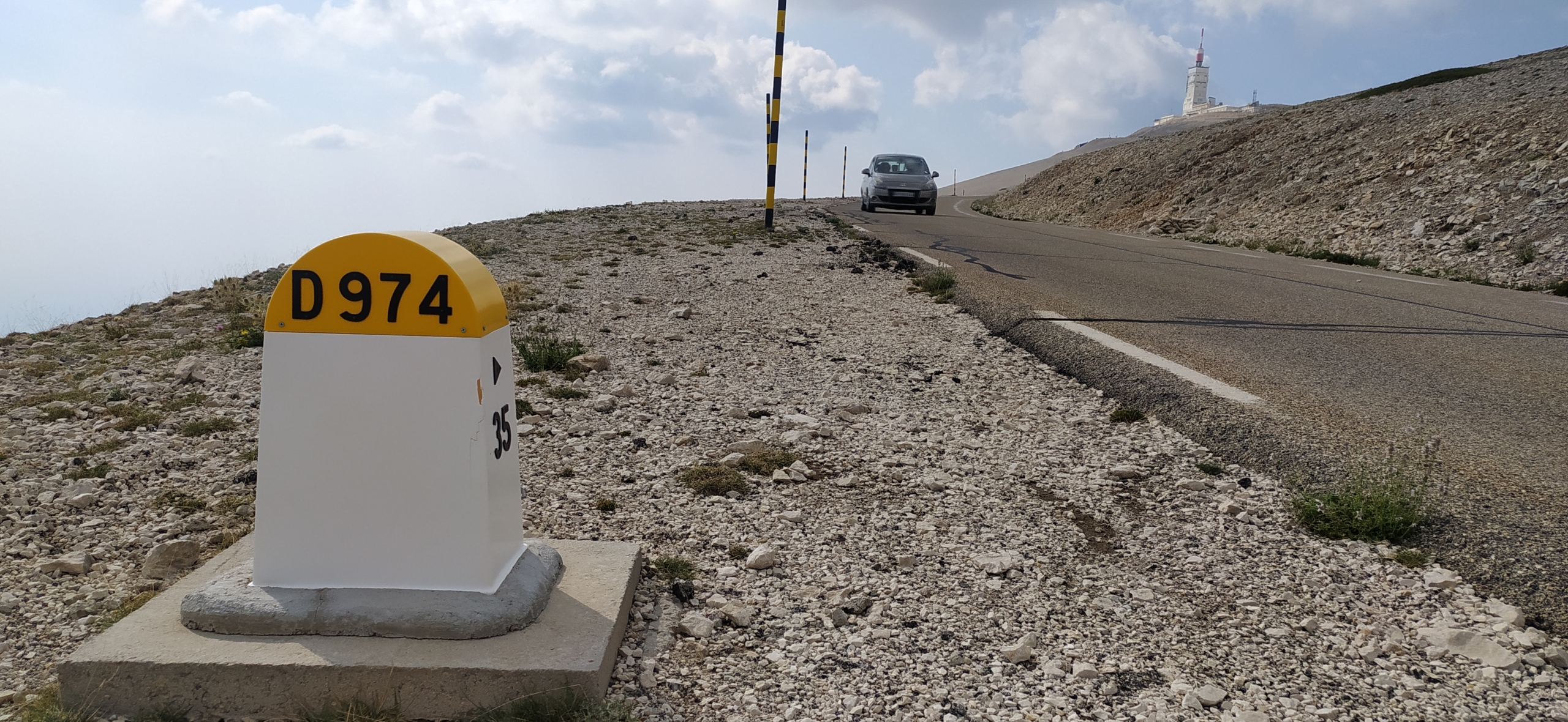
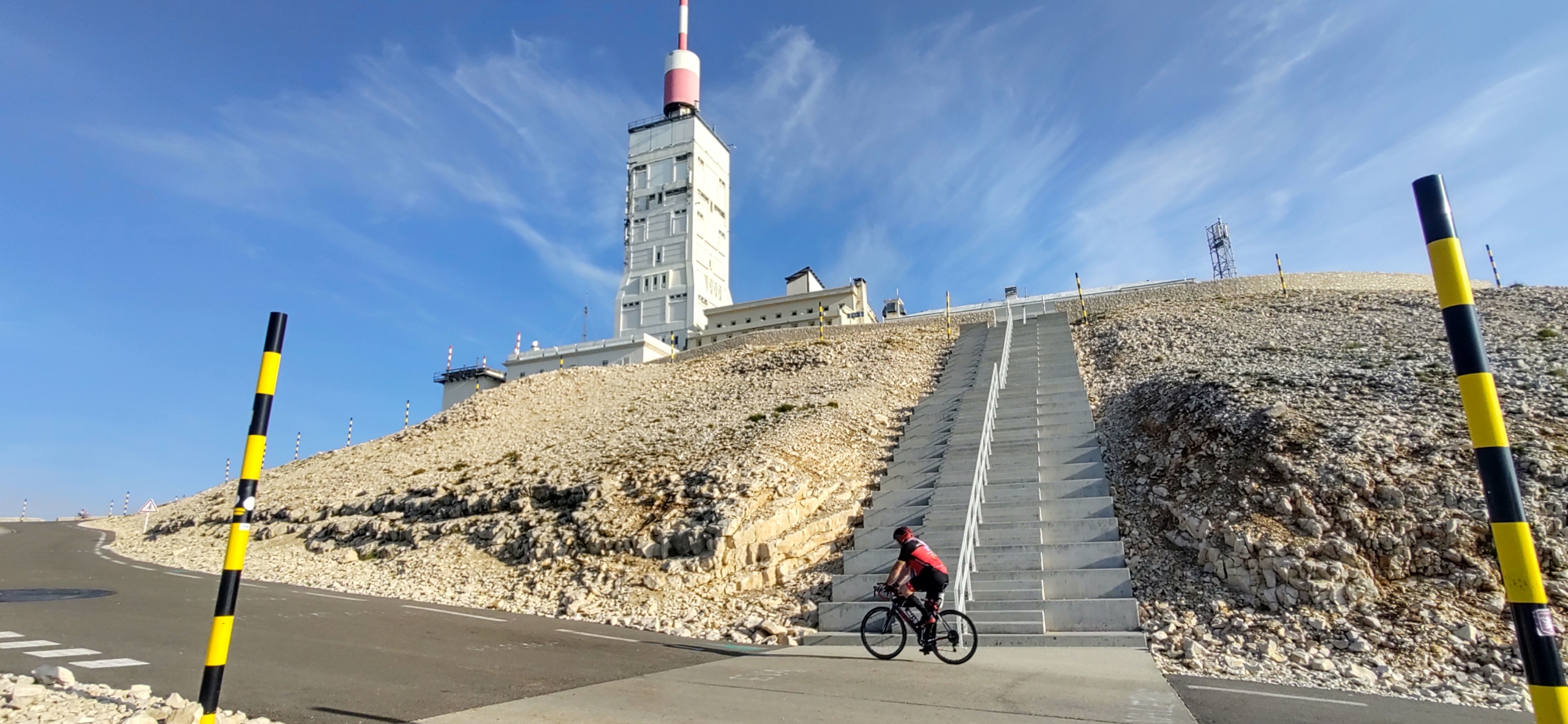
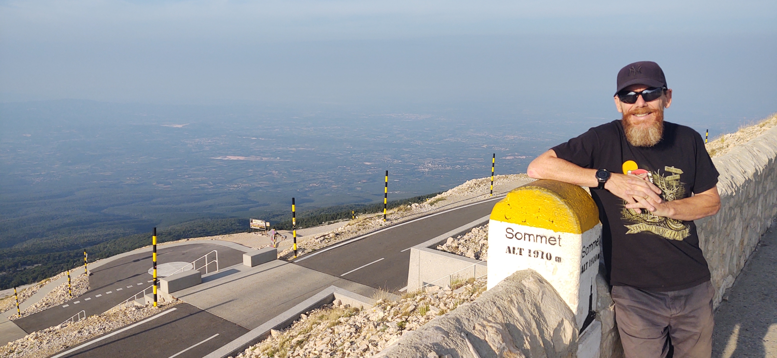
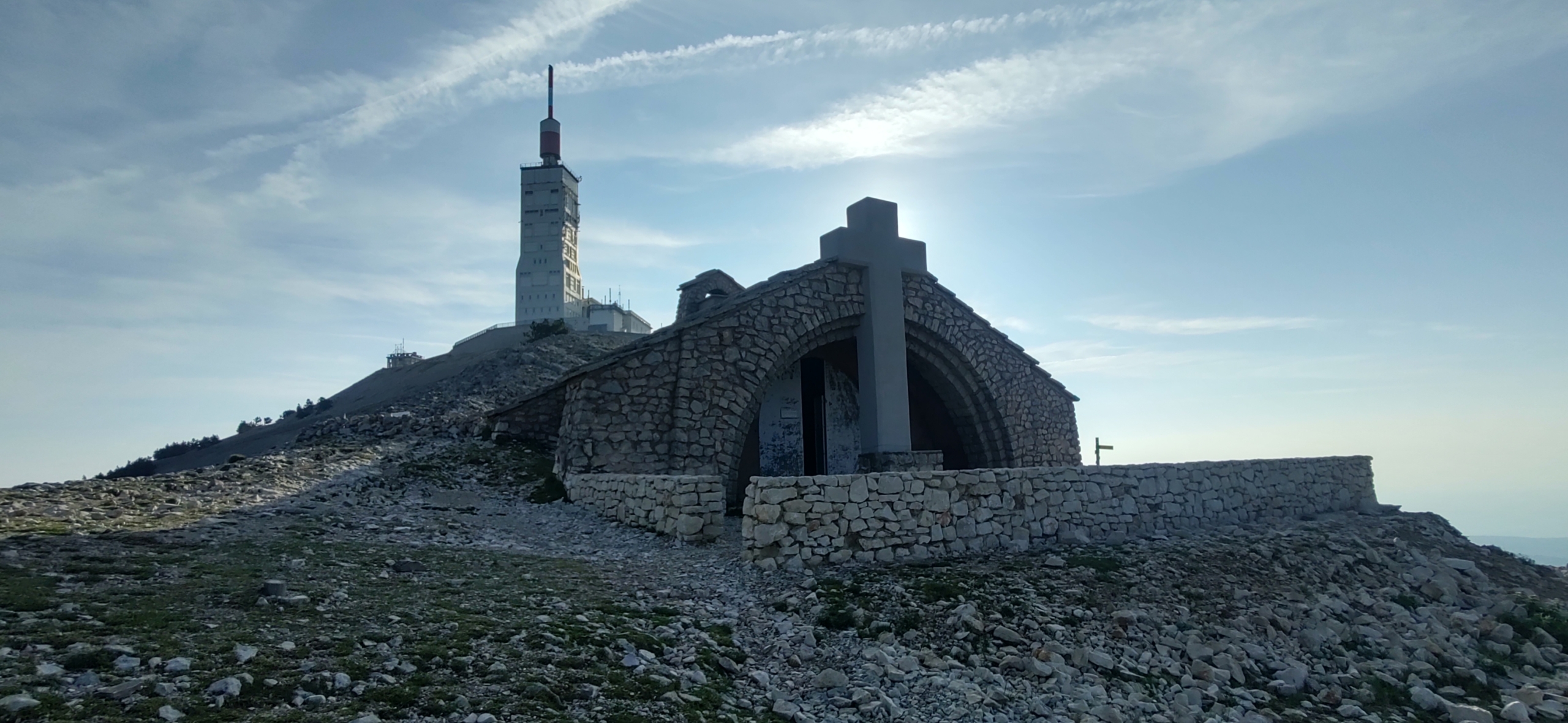
This morning we got up early and drove to the top at 1910m, finding it’s been completely redeveloped since we were last up there. Yeah, I should have spotted that when I was up there but my excuse is I was tired (!). There’s no longer any parking at the very top, other than for a restaurant, but there are gravel parking areas around 500m from the top. We picked one, pulling in with a few motorhomes and campers who’d spent the night up there.
The summit’s known for being mighty windy, one of the windiest places on Earth, with speeds of over 300kph recorded up there (it’s over 90kph for 240 days of the year and the road can be closed when it’s blowing hard). The few trees which survive are horizontal and half stripped of greenery. That’s why we avoided kipping up there, although there was only a breeze this morning.
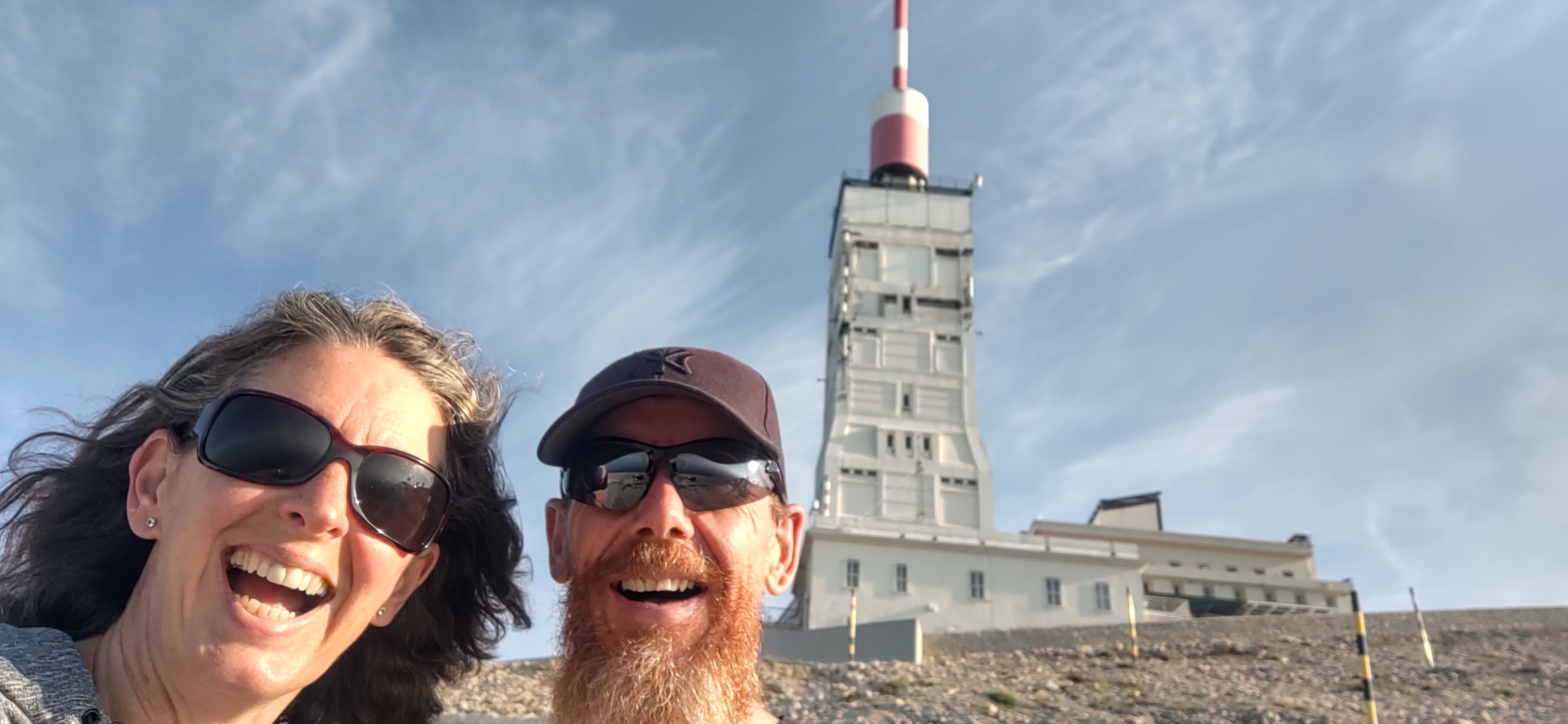
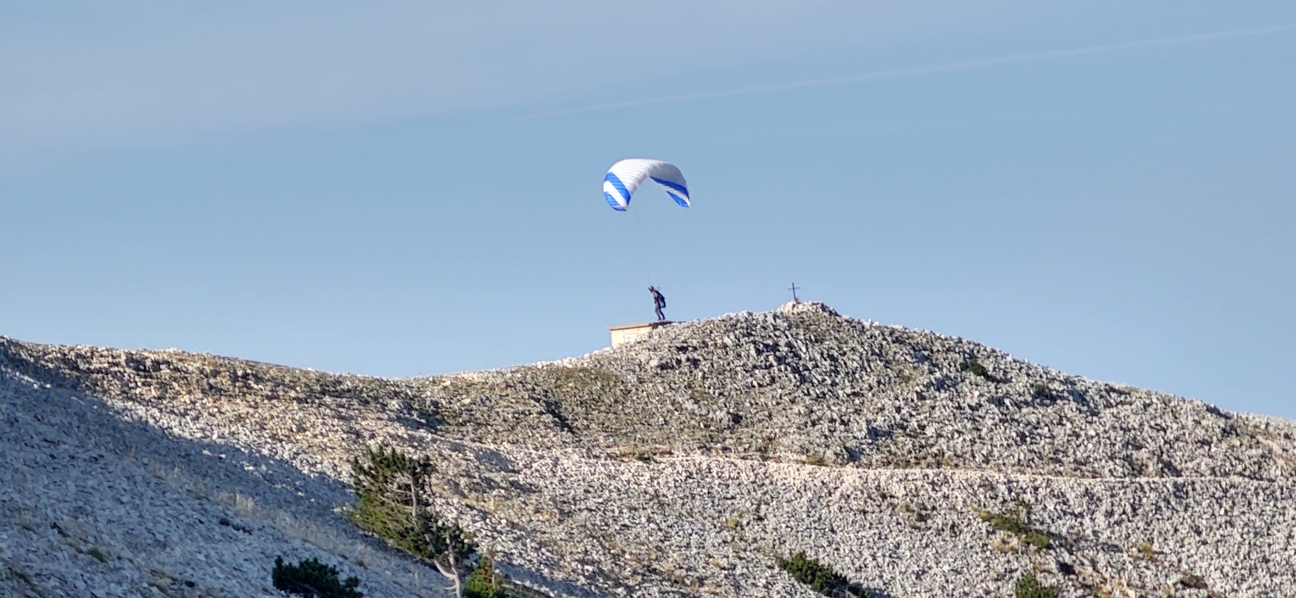
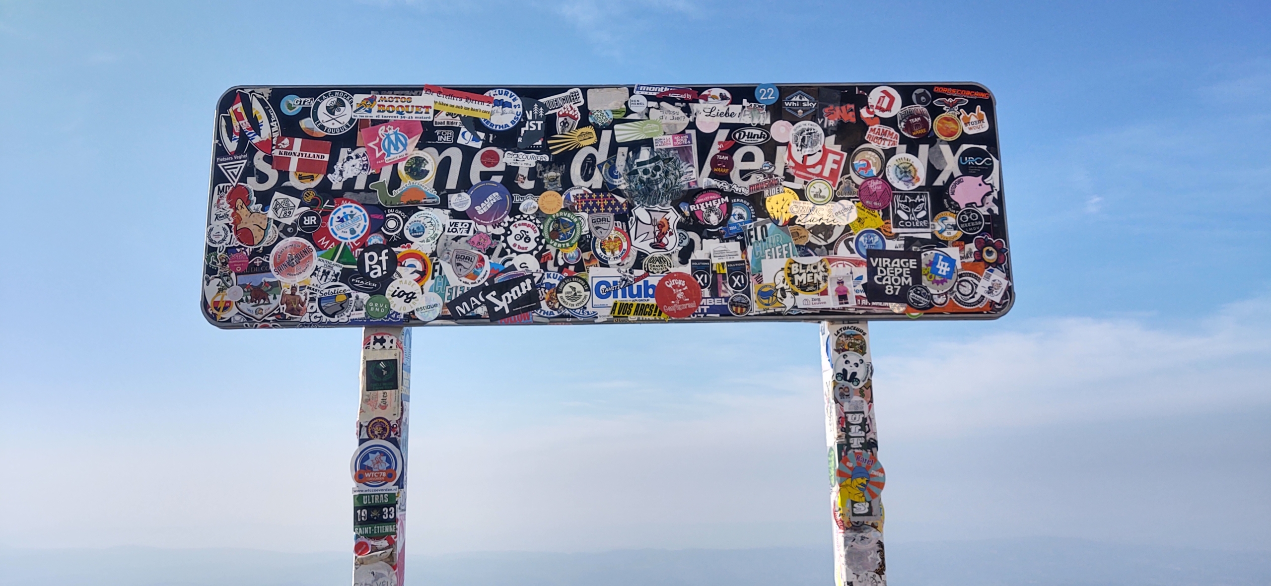
We enjoyed a long look around, doing our best to read the many information signs which are almost all in French. Tsk! :-) As well as the iconic (and arguably ugly) telecommunications tower, there is apparently an underground bunker which was used until the 1990s as part of France’s nuclear deterrent. We took in the panorama signs showing the names of distant mountains and where the big cities of Provence are located. With a nod or ‘chapeau’ or ‘well done’ we tried to encourage cyclists as they slowly edged their way the last few hundred painful meters. As with any of these mind-blowing viewpoints, we did our best to capture it forever in photos, but snaps can never do it justice.


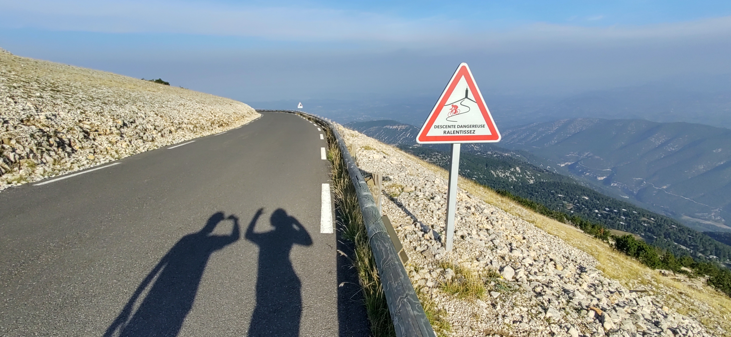
After breakfast and some more looking around we took to the road down to Malaucène. Again it’s in perfect condition, but boy does it go on. Miles upon miles of descent and even keeping the van in 2nd gear, revving up to 4,000rpm couldn’t slow us down enough without also using the brakes. We’ve had the brakes go spongy two or three times over the years on long descents in the past and it was no fun pushing that right foot down and not much happening! Wary to avoid this we pulled into a flat parking area in the forest after a few miles and gave the brakes, which were way too hot to touch, 10 minutes to cool off a bit.
Eventually the road flattened out, much to my relief, and we rolled through the countryside to Vaison-la-Romaine. Ju had found a campsite here as we knew the temperature would reach around 33 degrees today. Knowing that gets amplified in a glass-and-metal box, we were keen for the shade of trees. I’ll let Ju tell you about the town, but we’ve sweltered our way around and it’s proved well worth a visit.
Cheers, Jay
Thanks for reading folks! For all our best tips and tricks:


Leave a Reply
Want to join the discussion?Feel free to contribute!